Fairbanks to Deadhorse via the Dalton Highway (Alaska)
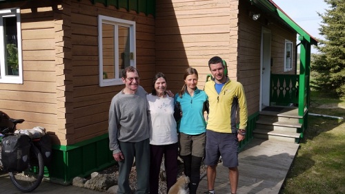
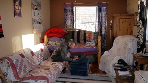
Janet North, a warmshowers legend hosts us for a few days in their self built log cabin, a tranquil haven among thick forest miles from the sprawl of Fairbanks.
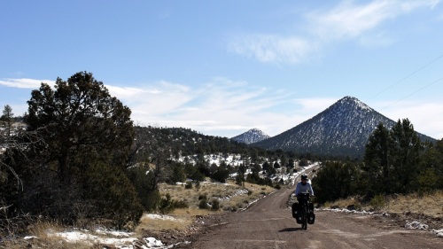
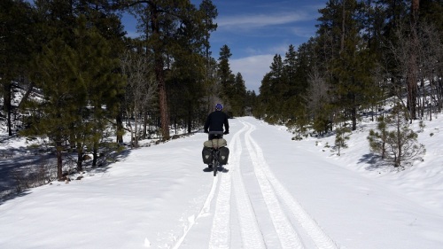
We dump all unnecessary kit, load our panniers with nine days worth of food knowing that if the weather’s bad the road will turn to a sticky muddy mess but if it’s sunny it’ll be dry and fast.
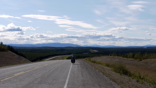
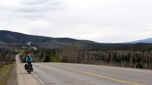
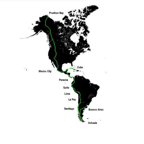
This is our last strech, a desolate 500 mile ride through a vast wild untamed wilderness. It’s going to be a period of conflicting and contrasting emotions as our journey draws to an end.
The first day out it’s that typical Alaskan mix of rollercosting hills, dense thick forests of pine, spruce and birch and remote wooden shacks with junk filled gardens.
In the late afternoon sun we stop for coffee and delicious home made muffins at the Artic Circle trading post. 25 fostered or adopted kids have passed through, home schooled at the homestead by Joe and Nancy.
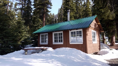
The first night we ride chased by mosquitos, by luck we stumble upon a BLM log cabin and make ourselfs at home away from the blood suckers swarming outside.
The tarmac ends as the Dalton highway begins, mile after mile of steep roller coasting hills, the road meanders through and around steep dome mountains. Progress slows to a crawl sweat soaks our t-shirts, lungs heave and legs burn, as temperatures soar high into the 80s and mosquitos swarm.
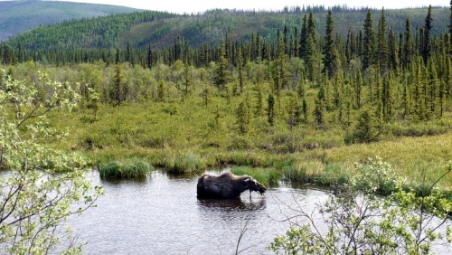
At mile 55 we cross the Yukon river for the last time and see a female Moose with a baby head down in the water mouths full of grasses.
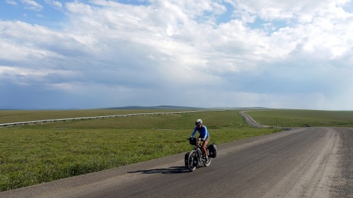
Trucks servicing the oil industry thunder by, clouds of dust coat us, loose gravel and peebles bounce and dance along the road. Most drivers slow giving us plenty of room, only the occasional driver passes at full tilt.
We reach the Artic Circle on the 21st June, at latitude 66′ 33′ m this means the sun won’t set, it’ll merely hover above the horizon before rising again signalling the coming of a new day. We’d hoped to sit and marvel but as the air cools mosquitos emerge and we retreat to the protection of our tent.
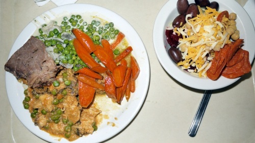
At $20 the Coldfoot buffet seemed an extravagent expense back in Fairbanks but after a few days on the road we’re ready to indulge and join the line of truckers and their rotund bellies. We skip the salad bar concentrating on meat and veg, two plate fulls later we’re ready to move onto dessert, the $20 also includes drinks and after a two hour sitting seems somewhat a bargain.
Afterwards we amble around the Artic Visitior centre to bloated to cycle, we watch movies on the pipeline, the road and the seasons.
Our riding now starts a little later, we’re no longer constrained by darkness so we ride late into the night, not as late as an american heading south who’s sleeping during the day and riding at night.
As we climb towards Atigun pass alongside crystal clear rivers creeks intersect the road cascading steeply downhill from rapidly melting snow, we stop filling bottles with pure cold refreshing water.
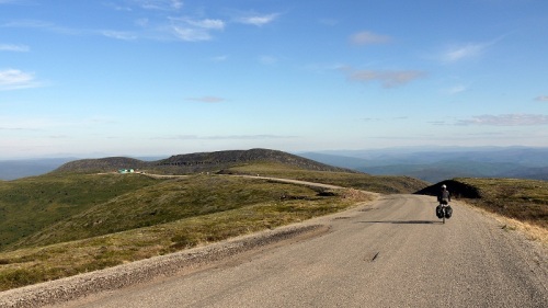
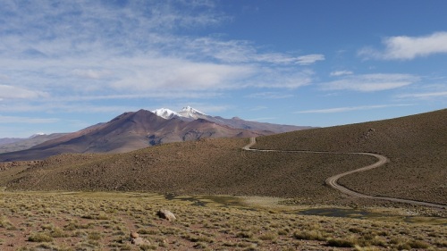
Climbing higher the trees recede behind us until we emerge in a landscape of barren rock falls, avalanche chutes and craggy rock faces. The road descends in either direction, we love this sort of riding and sit on the pass sipping a hot coffee contemplating the fact this is our last pass on our long journey north.
The trees are now gone, low shrubs, lichens and moss carpet the floors, flowers add colour as lazy rolling hills lead us northwards.
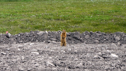
Despite recieving less precipitation than the Sahara lakes fill lower elevations and creeks slowly flow towards the artic ocean. Among the rocks along the roadside Marmots run and play, as we approach they stand on hind legs observing us with caution chirping a warning to others.
Alongside the Sag river the roads flatter, the water runs clear and cool, a Muskox forages and eats, for the animals here the summer is short, they rush to consume enough to sustain them through the brutal winters.
For the majority of the route the road follows the Aleyska oil pipeline, an engineering marvel that transports billions of barrels of oil from the oil fields around Prudhoe Bay to Anchorage.
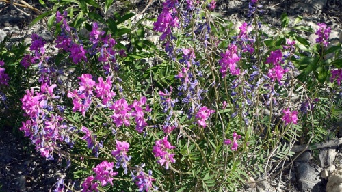
The autere beauty of the barren Tundra covered in flashes of blazing colour from early summer flowers, fireweed, cotton grass, wild sweet peas, alpine poppies and more. We see birds of prey, artic foxes, snow shoe hares and caribou.
The last 55 miles are flat into a cold artic headwind, the horizon stretches ahead bluring into watery mirage far in the distance. Birds abound in the flooded Tundra that stretches endlessly into the distance either side of the road.
Emotions ebb and flow as the last few days pass, contrasting conflicting emotions bring tears of both joy and sadness, pride at how far we’ve come and what we’re about to achieve.
Deadhorse is nothing but a collections of containers, rapidly constructed after the discovery of blackgold, it’s no place to end a trip and to be honest it’s a little bit of an anticlimax but after a trip of such wonder it’s no suprise the ending is an anitclimax.
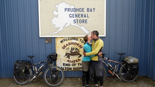
We feast on another all you can eat buffet after washing off 7 days worth of dirt, dust, DEET and sweat, take the obligatory photo at the post office.
After 7 hours hitching on the roadside until 2.30am we got a lift back to Fairbanks in an RV.
Back at Janet and Robert’s, it’s a double celebration, Robert’s birthday and completion of our journey. There’s endless food, ribs, lamb, salads, fresh bread, dips, sauces and plenty of beer, we eat and chat late into the night.
We’ll see what the immediate future holds for us the only certainty we have is that we’ll one day cycle again but in the meantime cannot wait to see our family again.
Whitehorse YK ( Canada ) to Fairbanks (Alaska)
In Whitehorse the hilarious Karl hosted us for 4 days, we ripped the local downhill trails, gnarly, rocky, berms, jumps, broadwalks, lower down trees razored by mere flashs of silver as we dodged between birch trunks.
Having come all the way to the Yukon we wanted to get a feel for life here during the goldrush when 100,000s of men headed north in search of gold and this meant a trip to Dawson City.
Whitehorse to Dawson took 4 days, we rode long days through forests of pine, spruce and birch, roadside verges brightly speckled with blooming flowers added dashes of colour to the unending forests.
At Braeburn lodge we stopped for the apparently world famous cinnamon bun. Expecting a delicately spiced treat we were disappointed to get a giant stale day old $10 bun, guess it’s world famous for being big, sometimes bigger’s simply not better but calories count and we rode energised late into the day.
Kilometers before Dawson City piles of dredged boulders lined the roadside a lasting reminant of the gold rush and 1900s style signs advertised the cities attractions.
Dawson City, cars aside is like stepping back in time, wooden boardwalks, dirt streets, wooden clapper board buildings, restored signage, old sternwheelers and modern day gold prospectors add to the alure and appeal of this one time booming and rich town once dubbed the Paris of the North.
A ferry hauls us across the mighty swolen Yukon and onto the top of the world highway. It’s a tough start, climbing for 20kms in unseasonally hot weather we struggle to find a rythm after so many flat and fast days.
Eventually the road flattens out but then settles into a relentless pattern of rollercoasting up and then down and up and down until legs are feeling like jelly and minds are becoming numb. We slowly gain height, above the tree line, bleak and barren, snow still metres deep lines the roadside, this small section reminds us of the Andes.
In the distance dark acrid smoke fills the air, a forest fire has caught, we gawp over our shoulders as the sun illuminates the bellowing smoke.

We camp at the roads highpoint in the cold blustery wind and roll down first inline for customs, the staff are friendly, chatty, jovial, now in Alaska the end is nearing.
Now on the apatly named Top of the World highway we’re back on gravel, it’s now the payback we’re losing height as we roll towards Chicken. The road snacks among stunted pines contouring around doomed mountains until a stream where we roll gently downhill the warm breeze sweetly scented by blooming flowers, the sky a perfect blue, cotton wool clouds floating lazily.
American mapping is terrible, derelict buildings, airstirps, road junctions, abandoned road houses, all are marked as settlements and Chicken’s another non town. They’ve got the obligatory RV park, a bar and a gift shop selling the usual tourist trinckets and endless chicken themed stuff but all we can buy are snickers and crisps when all we want is a loaf of bread.
Asking around we get chatting to two teachers who’ve just been out in the bush with some kids on a 9 day archeological dig. We chat and soon we’re being plyed with bread, fruit, trail mix, muffins, again we’re completely astounded by the generousity of the strangers we’re meeting on the road.
After months of not seeing a soul we’re now meeting cyclists on a near daily basis, mainly heading south, we always stop and chat, to share stories, to recall must see’s to talk about future adventures. Infrequently we happen upon a fellow north bound cyclist, the first an older Belgian is awkward talking in garbled sentences gesticulating widly, the second an American talks loudly and incessantly, a constant barage of noise, impossible to follow to understand a mere collection of random statement and opinions, we ride with niether.
But sat relaxing we spot another who turns out to be the relatively well known biciclown, a Spaniard who’s been riding for years delivering impromtu clown shows for kids, we sit and spend a wonderful 30 minutes in his company.
Now swarming in plague like proportions, the high pitched whine and accompanying mosquitos are an ever day part of summer here, our mosquito suits, a kind present from Chuck and Karen are worn religously during breakfast and dinner.
Like the majority of cyclists we avoid the ludicrisly expensive state and federal campgrounds, the word campground is a slight misnomer as the’re little more than gravel driveways for RV parking. But it’s late and raining hard, the surronding ground is wet and flooded from swollen rivers, the campground looks abandoned, the toliets are disgusting, litter lies on the ground and half the sites are overgrown. But at 6am a lady outside our tent is shaking the fly shouting ‘money’ within seconds she’s threatening to phone the police, we argue about the $18 dollar fee but it’s futile, we grudgingly pay up not fancying an early morning chat with the local gun tooting state trooper.
Good and Bad seems to have a habit of balancing itself out while on the bike and the next night after asking to camp at Sawmill creek we’re offered one of there cabins, it’s not been cleaned since last nights guest but the shower, kitchen and bed are welcome.
Flat roads through stunted borreal forests led us north, we see moose and their offspring, we pass warily, these awkward beasts kill more people a year than bears.
Passing Eilson airbase two F16s thunder down the runway passing us as they lift off then streaking high into the skies. The sprawl of Fairbanks greets us well before the town, we stop and meander around the 24/7 365 Christmas town of North Pole before rolling along the busy interstate into Fairbanks.
We’re met by Janet North, we stay for a few days out in the woods preparing for our last leg to the end of the world before our flights home on the 3rd July.
Smithers BC to Whitehorse YK
After a few days in Smithers fattening up for the long stretch ahead we’re ready to take on the Cassiar highway. Blogs suggest it’s going to be a tough, barren, desolate stretch with long distances between small isolated communities.
With trepidation and excitement we head north, a large sign proclaims we’re on the long road to Alaska. Soon we pass through Kitwanga and Kitwancool, 1st nation communities famed for their old wooden churches and totem polls that depict the history and status of the clans family.
The road narrows, through dense dark forest, our imaginations amplify the sounds, anxiously, nervously we look around for bears, we don’t sleep well on our first night out our imaginations run wild.
As we push further north the days are getting noticeably longer, even in late May it’s never really dark, the sun sets for a few hours but nothing more than an eerie twilight descends. Sleep takes a determinded effort and watchful eye on the clock, our minds and bodies not yet attuned to the midnight sun.
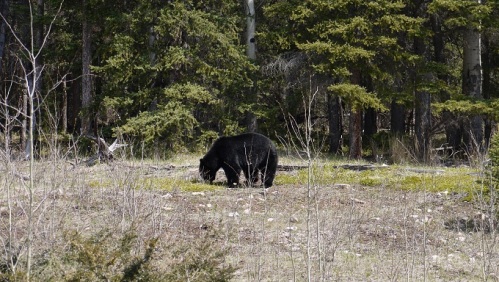
We’d been warned about the bears, as we approach the junction with the Stewart highway the frequency of sightings increase, shouts of bear ring out with disturbing regularity. The bears have just woken from hibernation, frenzied they sit by the roadside stuffing clumps of clover, berries or leaves into their mouths. Our approach is simple, we shout and hollar until they run of, most times this works, occasional a stubborn sow with cubs is indifferent to our shouting so we flag down a passing RV to escort us by, by the end of the Cassiar we’ve seen 41 black bears.
In Dease Lake, a remote 1st nation settlement we’re taken in by Brent and Karlee, two teachers at the local school. We chat late into the night about respective travels, the near constant daylight defeats our feeble time-keeping efforts. In the morning we pedal across to the school for an impromptu Q+A with the kids.
Further north on the Cassiar we see our first Moose. Awkwardly this giant beast lumbers across the road before crashing back into the willow and vanishing out of sight, it’s odd to think Moose kill more people annually than bears.
Occasionally we camp at roadside rest areas, not an ideal solution but in the black-swamp forest that makes up a significant portion of the Cassiar there is little alternative.
Preparing to pitch camp at the Bob Quinn airstrip rest area three hunters stop and chat. We tell them about our journey, and they ominously state ‘no I wouldn’t camp here, never know who’s goin be drivin by’. So we move on and camp with the loggers of BC Hydro who treat us to a shower and enough food for the next two days on the road.
The generousity of the locals continues to astound, we share a lakeside spot with two old timers in an RV, after the customary questions they chuck a steak over the flames and serve up the best meal we’ve had in weeks.
Nearing the Alaska Highway the mountains retreat behind us and the road undulates and lazily meanders through rolling hills covered in dense stunted pines, the occasional silver birch gleams in the bright sunshine.
The burn, an area of 40km square burnt after summer lightening strikes. Black darkened trunks stand naked, an odd eerie sight, the ground carpetted in bright grasses and lichen. Camps of mushrooms pickers have gathered to harvest the abundant fungi that grows after the forst fires.
The Cassiar only has one significant pass, compared to the Andes it’s only a mere 1241m but climbing from just above sea level it’s still a long drag, as we ascend the air cools until we’re again surronded by snow. Frozen lakes super cool the air whipping up violent headwinds that bluster and slow our progress.
That’s not to say the rest of the Cassiar is flat by any means, the road constantly climbs and descends nothing long nothing steep just endless rolling hills that meander through seemingly unending forest.
The Cassiar is a remote and isolated road, small communities dot the highway, a day or two apart they offer the chance to pick up snacks and other essentials. There’s a sense of isolation, a great wilderness and remoteness, that’s hard to find in the western world.
At times the unchanging scenery and monotony drags but we’ve really enjoyed the last thousand or so kms.
Now we’re in the Yukon, ready to explore the gold rush frontier towns.
Jasper AB to Smithers BC
Bruce our warmshowers host from Jasper works the trains, the skeena, a tourist train that runs north, with our panniers loaded on the train we ride lightened towards Dunster.
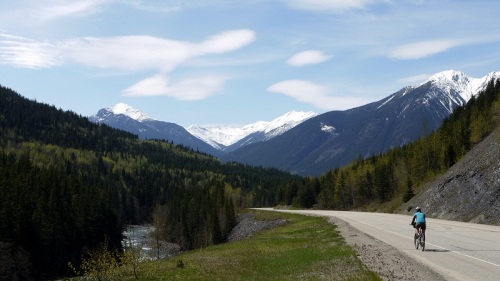
The mountains turn to rolling snow covered hills, dense dark forest encroach on the road and swollen rivers churn as the road cuts a meandering course.
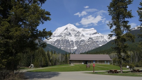
Mtn Robson the highest peak in the Canadian rockies stands tall and magestic but marks the passing of the spectacular mountains until further north.
Lower in elevation, springs arrived in the Robson Valley, leaves bud bright green and flowers bloom adding sparks of the colour to lush green pastures where cows lazily graze.
We arrive at Curtis and Bonnie’s just in time to sate appetites on the seasons first BBQ, neighbours arrive, the beer flows and conversations flit between hummingbirds, bikes and bears.
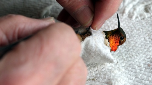
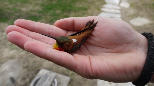
We’re enchanted at Curtis and Bonnie’s and stay an extra night, we simply cannot pass up the chance of catching, measuring and banding hummingbirds that fly-by during their annual migration.
With feeders hung all around the house hummingbirds buzz and dart around, to catch them Curtis hangs a delicate net around a feeder, a release catch attached to a fishing line drops the net while they feed. After delicately catching the bird by hand Curtis places them in a poncho style straight jacket and skillfully bands a leg before weigh and measuring the bird, the data recorded and sent to the Vancouver University.
It’s an incredible once in a lifetime experience, we’ll never forget.
The ride to Prince George is uneventful, nondescript, we’d go so far to even call it dull and tedious, this isn’t helped by the constant headwind that dampens our spirits. We’re now cycling through vast seemingly unending expanses of forest, trees, trees, and more trees.
But this sections not about the ride it’s about the people we’re meeting, the bikes and the open road continue to lead us to great, kind and generous people.
In Prince George, Ray opens his house and hosts us for two nights, abandoning the trappings of a sucessful career he’s downsized and spends months every year touring europe and the americas, throughly enjoying his 70’s.
Next up Vanderhoff, Deirdre welcomes us, the smell of fresh baked cookies greets us as we wander in, a moose stew awaits and the evening passes with talk of her future adventures.
Riding out of Vandehoff we’ve clocked up 100km early and are looking at a big day, two old timers clatter by on old mountain bikes, we exchange cheery hellos and cycle on. Minutes later Konrad and Gerda have caught us, we’re invited back to their farmhouse for the night. Again we’re treated royally, tea and biscuits followed by a roast and rhubarb pudding, a spledid round of pancakes powers us down the road the next morning where we have lunch waiting in Fraser Lake.
Friends of Konrad and Gerda’s invited us over, a Nicaraguan lunch of tortillas, meat, rice with beans and salad brings back fond memories of our brief stint in Central America, we depart fueled for a long afternoon.
More trees, beaver dam, bears, farmhouses and swollen rivers take us further north, rugged, steep snow laden mountains now rise in the distance, the Buckley valley.
In Smithers we arrive in time to bump into Dierdre who we met in Vandehoof and thank her in person for use of her Condo, we’ll spend a few days preparing for the long stretch north along the stewart-cassiar highway.
Canmore AB to Jasper AB via Icefields Parkway
The Icefields Parkway meanders for 230km from Lake Louise to Jasper passing glaciers, towering mountains, waterfalls and pristine forest and meadows. The tourist pamphlet describes this as one of the best drives in the world, we set out wondering if it’s true or little more than marketing blurb.
But first a network of cycleways return us to Banff and onwards to the Bow Valley Parkway, a quiet back road alternative to the busy truck laden highway.
Joining the Icefields Parkway grey skies descend, low cloud and snow flurries, the wonderous views vanish in the gloom.
Taking pity on us an Aussie couple invite us into their RV offering hot tea, as the snow starts to come down we’re enjoying a cuppa but soon our gratitude is being tried. After 20 mins of mind numbing gabber about topics as dull and tedious as Aussie toilet design and the percentage of roads paved in Australia we escape happily back into the cold snow.
Instead of gritting teeth and stubbornly pushing on we stop early, after all this is supposed to be one of the most spectacular roads in the world and we want to enjoy it.
Mosquito creek campground is supposedly open but with 1 metre of snow covering the ground we simply don’t fancy spending the rest of the day shivering in the tent. The HI hostel over the creek also has a sauna and for three hours work we can get a room for $24.20 so it’s a no brainer. After 3 hours shovelling snow and hauling logs we fire up the sauna, and soothe sore muscles with blocks of ice chiselled from outside.
The next two days are all but perfect, blue skies, the occasional fluffy white cloud but a constant tormenting blustering heavy headwind slows us down, we don’t mind this is no place to rush along head down we much prefer to stare in wonder.
The road is spectacular, 230km of stunning views, magestic mountains tower high where snow runs down to the tree line, glaciers hang suspended, clear turquiose rivers flow, mighty waterfalls tumble and pristine meadows provide good grazing for elk, cariboo and deer.
We’ve been promised bears and we’re not about to be disappointed, a young Black bear grazes lazily on berries roadside playfully rolling around in the warm spring sun. Oblivious to the gathered crowd the bear merely eats its full before ambling back into the woods.
We’re still out of season so avoid paying the extortionate entry fees and with campsites closed and higher ones covered in snow we simply setup camp for free in the cookhouses huddling close to the wood fired stoves as the sun descends and temperatures plummet.
Rolling into Jasper, tourists swarm around, lattes in hand, cameras hanging around their necks, again we feel awkward in our now worn and tired day in day out clothing. We spend the evening with Bruce a new-comer to warmshowers happily chatting adventures and bikes.
The Icefields Parkway is not a tiring exhausting epic like the rides back in the Peruvian andes, it’s a mellow relaxed pedal but for spectacular wonderous views it’s well up there, one of our absolute favourites, a must do for any long haul cyclists crossing the continent.
A Micro Adventure – Hiking and Biking around Canmore
We’re not so good at sitting around and doing nothing, the fresh air, the stunning views and the excitement and exercise of getting out there are an addictive blend. After a day spent sourcing replacement bike parts, updating the blog and uploading photos we needed to go play outside.
With the help of Alex and Megan our warmshowers hosts we planned a morning mountain bike ride followed by an afternoon hiking/scrambling up Ha Ling one of the many majestic peaks that tower above Canmore.
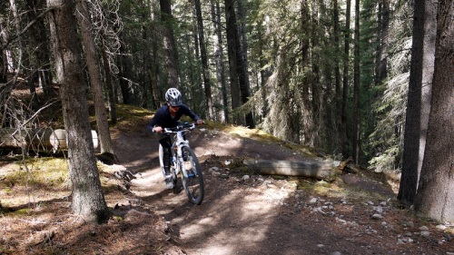
On borrowed 29ers we blasted around the singletrack of horseshoe loop in the pine forests above Canmore.
Nothing overly technical, simply nice fast flowing singletrack.
The bigger wheels smoothing out the roots and rocks as we blasted through the trees.
After a hurried lunch and some frenzied packing we jumped back on the bikes and rode up to the trail-head for our climb of Ha Ling. After a 10km slog uphill we reached the trailhead, Ha Ling, an awesome peak of jagged jutting rock towered above us.
Alex loaded 20 month old Finn into his Ergo carry pack and we pulled day packs onto our shoulders. The trail cut steeply through dense pine forest, the surface damp and and muddy from recent snow melt, the floor covered in a verdant green of moss and lichen.
Halfway the snow pack increased, to improve grip we pulled snow chains over our trainers and continued to slowly gain altitude.
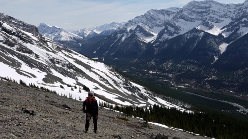
Emerging from the tree line the snow pack disappeared replace by loose awkward scree, we scrambled up the steep slope on our way to the top.
The views of Canmore, the surronding mountains and pine covered valleys in all directsions made up for tired legs, the howling wind meant out time on the summit was shortlived.
To speed our descent we slid and slipped back down to the bikes and before long were back in Canmore enjoying roast vegetable soup and double portions of apple pie and ice cream.
Whitefish MT (USA) – Banff AB (Canada)
Way back in Moab we chatted with Monica and Robert, two keen cyclists, they took an interest in our journey and after we explained how long we’d been on the road they offered us use of their cabin in Whitefish MT.
After 32,000km of riding Sylwia’s rear rim is badly dished and with 4500km of sand, grit and water ahead as we make our way up to Alaska we take the opportunity to relax in luxury and get a new wheel built. Unable to get a Rigida CSS rim we opt for a Sun Ringle Ryhno.
A week passes as we wait for the bike parts, we don’t mind, the cabin is rustic luxury at it’s best, set among pine and birch deer wander the backyard. We’re forever grateful to Monica and Robert and our chance meeting.
For the first time in a long time it’s raining, not the torrential downpours of central america or the rumbling thunder of Colombia but the grey drizzle of an English autumn where clouds linger low and the world looks bleak and miserable.
With waterproofs on and our feet in plastic bags we glumily cycle away from Monica and Robert’s beautiful log cabin. The grey clouds hang low, a light drizzle falls and cars pass in a cloud of spray, our moods are similarly gloomy.
In preparation for this bout of bad weather we’ve lined up a series of warmshowers host, an opportunity to get out of the rain, dry our gear, sleep in a comfy bed but more interestingly meet some interesting folk.
Excitedly we cross the border into Canada our 14th country. 1st impressions count and Canada appears to be one huge pine forest a vast wilderness, we go hours without passing a town only rumbling timber mills.
Our first night camping is at Wasa Lake, oddly we’re still in the winter season and snow lies deep on the distant mountains that tower above the lake.
Bearanoia creeps up on us as darkness descends, our imaginations magnifying the smallest noises, we sleep fitfully.
At Fairmont Donna and David host us, there spectacular log cabin a tribute to all things two wheeled, we eat well and chat long into the evening about cycling.
At Radium hot springs we stop, soaking weary muscles as cold rain falls, as we leave for the long climb to the first pass the sky clears and the sun makes a welcome return as we slowly gain altitude.
The climb goes through deep canyon, narrow sheer rock faces, cascading river, dense pine forests, scree slopes and snowy mountain peaks.
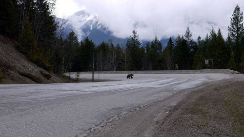
Bear, bear, bear, look it’s a bear!!! We stop slack jawed, hearts racing as a grizzly slowly wanders across the road and disappears back into the forest.
Our planned camp site for that night was under 3 ft of snow melt, exploring the closed lodge opposite, a door swings open as we knock, invitingly there’s a brand new bed, with the image of the bear still in our mind we bolt the door behind us and sleep heavily.
Overnight we can hear the all too familiar pitter patter of rain, but in the morning we wake to a light dusting of snow. We cycle in low grey cloud, the trees coated in fresh snow, an eerie hypnotic silent world we cycle trance like mesmerised by the beauty of this winter wonderland.
Covered in dirt we ride into Banff, we feel out of place in our day in day out clothes, the tourists stare as we take a coffee and cycle about main street, we’ve not seen tourists on mass for months now and it’s making us feel a little like dirtbags.
We’re going to hang out in Canmore down the road and sort out some new sprockets for our Rohloffs, one has lost two teeth already and the other has been reduced to nothing more than 16 point spikes.
Riding ‘road to the sun’ – Glacier National Park MT
The Road to the sun is an engineering marvel and National Hisoric Landmark which goes through the heart of the park over Logan Pass. In spring time the ploughed road is open only for bikes , another ride we simply couldn’t miss.
Wanting to explore Glacier NP in one day we decided to hitch from Whitefish to the park and back, this saved us some 50 miles of boring highway riding and allowed us to spend the whole day enjoying the park.
Entering the park we cycled along the park’s largest lake McDonald where the clear water reflects the big and dramatic Montana skies.
The ride climbed steadily starting in dense green pine forest, snowy white dramatic mountain peaks high above, striking rock faces and huge avalanche chutes.
As we climbed above the tree line the snow increased until we rode in a tunnel of snow towering up to 18ft.
Suddenly we could pedal no more, the road blocked up by deep snow.
Livingston MT to Whitefish MT
John and Lauren from Livingston suggested a stay with Barb up in Wilsall, they didn’t say too much except she’d killed a Bobcat by hand a few years back. Intrigued this was enough for us to take a half day, well that and the demoralizing headwind and snow.
Barb’s 68 years young, a feisty interesting women, who hunts, rides horses and works with the disabled, she treats us to homemade deer sausage and gives us a bag of jerky for the road.
Travelling north we’ve pedalled into more than our fair share of headwinds, we envy those going south, it seems incalcuably easier. But we’ve become used to gritting teeth, squatting down and grinding out the miles. For days now we’ve been battered and beaten by demoralizing unrelenting headwinds as period of cold weather and blustering winds blew in.
This Spring’s been hot with record breaker temperatures, the weather swings between freezing cold windy storms that barrel in and stay for days and tranquil periods of sunny blue skies.
The riding’s mellow and relaxed passing through wide open agriculture plains with vast circular fields irrigated by huge pivot water systems. And lush green fields where young calfs and cows graze, occasionally we pass red and white wooden barns and rambling raunches.
In the distance mountains rise to snow capped peaks and glaciers. Spring is in the air, leaves are starting to bud, flowers are starting to bloom and young wild animals run with their mothers.
We’d be given Mary Rose’s details back in Victor and with merely a days notice she welcomes us into her home. We share a pork chop dinner with Al her son and friend Dave who’s 91, converstions meander from Bolivia to Dog Mushing to Camp Rimini and WWII.
It seems warm and dry enough to attempt a return to the great divide route, all seems to be going well as a fireroad meanders deep into pine forest.
As we pass 4500ft patches of snow appear, the roadbed wet and soft and despite a road closed sign we press on. Nearing 4750ft there’s snow and we’re reduced to pushing, the snow’s 1 metre deep and wet and slush, after 5 miles of pushing we abandon the great divide and descend back to the highway.
The altitudes now below 3000ft, thick dense forests line the roadside and long narrow lakes reflect the distant mountains on their mirror like surface.
We ran into Monica and Robert back in Moab, after a brief chat they offer us use of their cabin in Whitefish. Their luxury traditional log cabin sits a few miles out of the town among pine and silver birch, a perfect place to spend a few day resting and relaxing. It appears that Canadians are just as generous as their US cousins.
Jackson WY to Livingston MT
On a bike friendships are distilled and condensed into hours or days instead of weeks and months, they’re over almost as soon as they’ve begun. Sadly we bid farewell to the Teasley’s, better friends we could not have hoped for, hoping to see them again soon.
Despite record temperatures this spring there’s still plenty of snow on the ground especially above 6000ft and snow storms and freezing temperatures are a near ever day occurance.
This means rejoining the great divide route is a no go and rules out dirt roads which if not covered in snow are soaked with melt water so we plan a paved route north.
Climbing Teton pass backcountry skiers carve turns in deep powder, we descend as another snow storm rolls in.
Our first day out of Jackson is a short one to get us back in the groove, at Victor we’ve got a log cabin waiting. John and Barb welcome us, we share stories about life on the road and eat bison tacos.
Trying to avoid tarmac we detour onto an unused railway line, a mellow ride, the trail damp and soft from recent snow melt cuts through wide open raunch land.
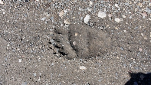
At this time of the year bears are just waking from their winter hibernation, we spot some tracks in the mud on the railway, another reminder as if we need one, like most cyclists we’re suffering from a healthy dose of bearonia.
It seems as if we’re the first tourists here, it’s the shoulder season between summer and winter and for Yellowstone NP this means spring activities, a great thing cause the roads through the park normally choked with 4 million summer visitors are only open to bikes.
In and out of the park in a day we we pass through dense pine forests, sprawling snow covered meadows, frozen lakes, cascading rivers and off course geysers, mud pots, hot springs and fumeroles.
It’s a wilderness, pure and untamed elk, deer, long horn sheep and bison graze lazily on the first spring grasses and birds of prey glide grazefully over head.
As we exit the park at Mammoth hot springs clouds ominously gather and within minutes the first flurries of snow begin, we spend time watching the promotional videos in the tourist information, reluctant to pitch camp.
Aimlessly wandering around the tourist store, a drawling Texan accent asks “where y’all goin?” after explaining we’re offered bed and a good feed at Jerry and Linda’s trailer. We’ve now become accostomed to such stunning generosity and spend the evening chatting bikes and adventures.
Before hitting the road the next morning we take a trip down to boiling river hot springs, it’s not really a hot springs but the confluence of the boiling river which is as the name suggests is a river of boiling hot water and the frigid cold yellowstone river. Pilled up stones provide different temperature pools to bathe in, a perfect way to soak tired muscles, slowly dark clouds gathered a bitter wind blows and snow flakes fall prematurely ending our soak.
Descending away from the yellowstone plateau a blizzard soaks us but before long the skies clear and we ride under blue skies. The road follows a narrow canyon alongside the river before widening into golden agricultural plains with snow capped mountains in the distance.
In Livingston, a once thriving railway town John and Lauren host us, we wandered around town, neon lights and retro signage illuminate the gloom and after a few local beers we ambled home and sleep soundly.
Riding the Tetons WY
Wondering around Jackson we stumble upon the brew pub, signage outside proclaims award winning brews, enough said, we cannot resist. The beer’s good and while enjoying a surprisingly good english ale Frank wanders over and insists on buying a round, who are we to say no. A few hours later after agreeing to join Frank and Stacey the next day on a ride around the Grand Teton NP we swing our legs unsteadily over the bikes and pedal back to Chuck and Karens.
The Grand Tetons or to translate the name given by some decidedly lonely French explorers ‘the three tities’ is a small national park south of Yellowstone. Immense majestic sheer granite peaks rise from the flat river valley.
It’s spring time, the roads have just been plowed and opened to bikes only, snow still lays thick on the ground and lakes are still frozen solid. The cycling is breath taking and the company great.
It’s a rare joy to be cycling free of the hazards of cars, with over 4 million annual visitors this is no place to cycle in the summer months.
The roads full with cyclists, families dawdle along, couples ride romantically and lycra clad speedsters race by even the occasional inline scater glides by.
After 3 nights at Chuck and Karens we return to Frank and Stacey’s for another 2 nights. We share stories and adventures and learn a little about dog mushing.
Moab UT to Jackson WY
Having heard about the 142 miles Kokopeli trail we wandered around Moab seeking further info, oddly everyone suggested it’d be a great ride. As we prepared to roll Teri-Ann our warmshowers host suggested the first half of the trail in the La Sal mountains would be covered in snow and mud.
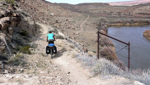
Amending plans at the last minute we rode to Dempsey Bridge, but here the Kokopeli trail was an unrideable mix of tyre swallowing sand and large rocky drop offs.
We did ride some of the Kokopeli trail, only about 25 miles as the trail wound through sage brush, but other sections involved struggling and pushing along virtually unused singletrack. Simply put the Kokopeli trail is too technical and too tough for loaded touring bikes.
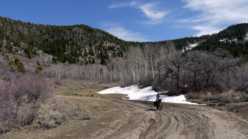
Heading more directly north a dirt road takes us towards Baxter Pass, it’s been an unusually warm spring and the winter snows have been light so were hopefully it’ll be rideable. As hairpins take us higher patches of snow appear amoung the trees, approaching the pass the track narrows, we dodge rocks and boulders from recent landslides.
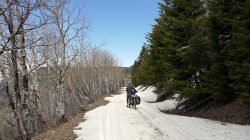
Over the pass everything changes, now on the north side of the mountain there’s snow, lots of snow, for the next 3 miles we push our bikes through snow, mud and ice. Hardly the flowing downhill we’d hoped for as we slogged up the other side.
Descending lower the snow clears, we navigate a rain runnelled trail back down to the dusty dry desert passing old mining ghost towns.
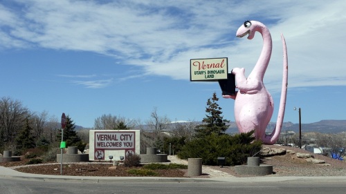
Rolling into Vernal we pass a large pink dinosaur, the area is famous for dinosaur remains and proudly celebrates this. We stay three nights with Patrick another fantastic warmshowers host. We did try to leave after two nights but after 15 miles of climbing Patagonian strength winds and snow defated us and we descend back to the warmth of Patrick’s house.
We’ve been in the high desert for a while now, it’s an odd lunar like landscape covered almost exclusively by sage bush. After the pass out of Vernal this changes and for a while we’re in high pine forest, at this time of year snow still coveres the ground and the lakes are still frozen solid.
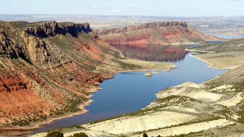
Leaving the frozen forest behind we descend through Flaming Gorge, red and orange rock formations layered in strata contrast with the bright blue waters of the reservoir.
Returning to high desert and sage bush we’re accompanied by elk, deer and antelope. In Green River Todd and Becky host us, we’re treated to succulent beef, insightful conversation and obligingly too many beers.
Continuing along the high plains of Wyoming we camp riverside, old timers have gathered for the start of the trout fishing season, they come across to chat, we tell them about our journey and they gift us a pile of logs for a fire that evening. We stand warm around the flickering flames, as the sunsets an owl emerges and the stars shine brightly, the simple pleasures of bike travel.
We’ve constantly been told we’re a month early, but the springs come early and the weathers good in the main. But one day a week a storm front will move in, this one brings 40mph winds, temperatures drop to below freezing, we ride wrapped up but still cold, the wind raw and bitterly cold, with windchill its more like -10c.
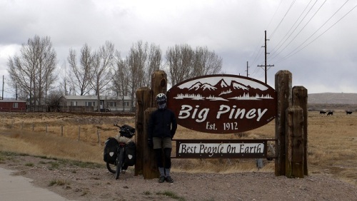
Rolling into Big Piney the town sign proclaims it’s the coldest place in the nation, it definately feels it today, we retreat to the gas station and sit nursing our coffee. After an hour we wander over to the hotel across the road, explaining our situation we get a room at the Big Piney Motel for $20 dollars, we’re forever grateful and even more so when we see the weather forecast, over night temps drop down to -20c.
We struggle to leave the warmth of the motel room, at 8am it’s warmed to a bone chilling -11c so we delay but the suns out and the skies clear. In the grocery store a young guy asks about our journey and then returns a few minutes later inviting us to breakfast at the fmaily home.
Eggs, Bacon and coffee, we don’t need to be asked twice and back track a mile, the whole family has gathered for Easter, they’re bike nuts and we slip into conversations about bikes,riding and south america. As we hit the road again we reflect on the immense generousity of americans.
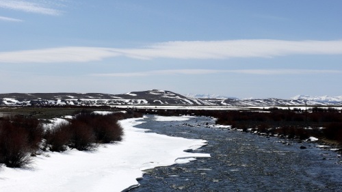
There is one more pass into Jackson, the sky is clear and rising out of the sage bush on either are snow capped mountains. As we climb there’s more snow, everything is white and the rivers are still partly frozen having only just defrosted after their winter freeze.
Over the pass it’s a different world, steep mountains rise all around, streams and rivers support young brightly coloured willows and snow is everywhere. Roadside signs tell us to be bear aware, we don’t need reminding, we free our bear bells and reassuringly touch our bear spray securely strapped to the bike frame.
Camping on the snow doesn’t appeal so unable to make Jackson we climb up to a house on the hillside, we’re taken up to the main house and introduce to Stacey Teasly. She’s a bundle of energy and enthusiasm, with her husband Frank they run dog sledging tours and we’re introduced to the dogs, all 176 of them. They cycle so understand how we’re feeling and provide us an apartment to stay in, again we’re warm and reflecting on the generousity of the americans we’re meeting.
As we roll ever closer to Jackson it’s becoming more affluent, large wooden houses and expensive cars. Chuck and Becky welcome us warmly into their beautiful home. We’ll stay a few days as once again we need to plan our route north.
Slick Rock Trail – Moab UT
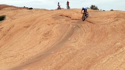
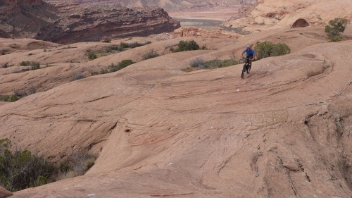
Slick Rock is world famous and we couldn’t resist. The Poison Spider bike shop agreed a two for one special deal for us so we went all out, Sylwia picked the Kona Hei Hei Deluxe and Matt went for the Niner R.I.P 9.
It goes without saying, both bikes are full suspension but out of curiousity we opted to try out 29 inch wheels and are now both converted to big wheels, we simply loved them.
After slogging 2 miles uphill we reached the trial head, Matt was so excited he giggled like a little girl.
The 2.2 miles practice loop is every bit as tough as the real thing but allowed us a little time to get used to our new bikes and the peculiar sandstone surface.
The trial is marked out by a series of white lines painted on the rock.
And requires a fair dose of technical skills to ride the steep drops.
Despite being only 9.6 miles long it’s a tough ride as the trial climbs seemingly impossible gradients.
The extremely grippy sansdstone allows mind boggling cornering angles, we both ran out of nerve long before our tyres ran out of grip.
And near vertical descents where we were glad for the immensely powerful disk brakes on our bikes.
We’re a little lost for words to really describe Slick Rock, it’s like nothing we’ve ridden before and is truely unique, we loved every second of it.
The White Rim Trail – Canyonlands National Park UT
Making up for the disappointment of leaving the Great Divide we set out to cycle the 103 mile White Rim Trial.
Moab is 32 miles from the national park so we load up the bikes with enough water and food for 4 days and headed out into the wilderness.
Instead of following the main route into the park we took the Potash road which winds it’s way along a steep walled red rock canyon before a dirt road climbs into the national park.
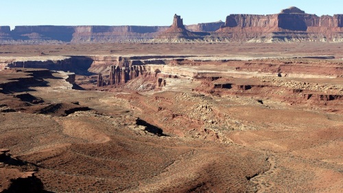
The trial follows the edge of a broad mesa between the canyons carved by the Green and Colorado rivers providing an incredible array of views.
Over millions of years water and gravity have cut flat layers of rock into hundreds of canyons, mesas, buttes, fins, arches and spires.
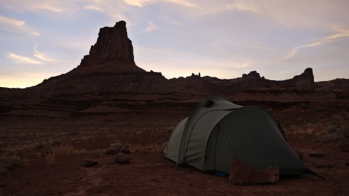
Some folks ride the 103 miles in single tough day but as this was supposedly a relaxing side trip we decided to spend 3 nights camping in the park. Camping out allowed us to enjoy the changing colour of the rocks as the sun set and then rose again the next morning.
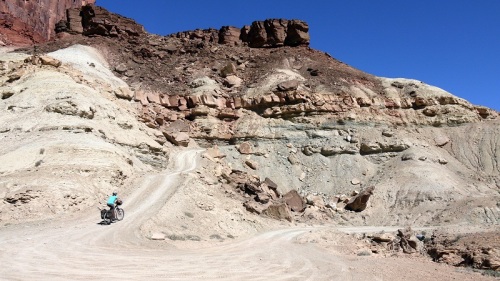
For the most part the trail is an undulating flowing ride allowing plenty of time to gawp in amazement, occasionally steep loose climbs quickly tire legs as we propel over 20kgs of water uphill.
Lunches were taken perched on the canyon edge, the dizzying drop had little impact on our ravenous hunger.
The trial varied from slick rock to bed rock and sand to hard packed dirt.
The trial ended with a short climb back up onto the mesa and then a long paved descent back into Moab.
The White Rim trial is a classic, right up there with our all time greats, and with the weather in the high 80s we’re not missing the snow and freezing temperatures of Colorado.
Pie Town NM to Moab UT
We’ve had to make a tough call, it’s simply too early in the season to head much further north on the Great Divide. In Colorado Overnight temperatures are still the wrong side of -10c and upwards of 70 inches covers the ground above 8000 metres.
So now we’re heading west into Utah, it’ll still be cold, there still the risk of snow but we’ve at least got a chance of making it through. And being a mountain bikers we’ll be scheduling a stop in Moab to ride slick rock and a route around canyonlands national park.
Heading north out of Pie Town still on the great divide a flatish fast dirt track soon has us in Grants. We stop in McDonalds for what we’re now calling a McInternet stop, a local couple stop and chat and donate their map to us, unbelievably nowhere in town sold one and we retreat relieved to a cheap roadside motel to plan our route over to Moab.
Our route is now an assortment of quiet back lanes and dirt tracks that cut across the Navajo Nation south to north. This semi-autonomous native american governed territory covers 27,000 square miles and is home to only 300,000 people.
The area is defined by long rolling hills, deep canyons and towering rock formations carved over millions of years from the soft local sandstone. Oil and gas rigs and wells scar the landscape bringing much needed monies in for the indigineous Navajo.
Rolling over to ask two Navajo men directions we’re soon sat inside having breakfast with their extended family, treated like old friends we linger eating eggs and bacon. As we drag ourselves away, back out into the cold wind they replenish our snack supplies and tell us to keep in touch. So far we’ve be touched by the kindness and generousity of the Americans we’ve meet on the road.
Nearing Moab we avoid the heavy traffic of state highway 191 instead taking the Montezuma Creek Canyon road.
For 35 miles this dirt road winds up the canyon passing ancient petroglyphs, cave dwellings and ruins.
As the canyon narrows the walls of the canyon turn to slick rock and tower above us as we ride through sage bushes which as we gain height give way to knarly stunted pine trees.
Climbing out of canyon patches of snow are visible, stopping for a caffeine hit in Monticello the anticipated snow storm blows in, from the warmth of the Peace Tree cafe we watch as the blizzard rages and waves of snow are blown across the highway.
Stumbling out into the snow storm, we’re fortunate the wind is on our side and we make good progress.
Tom our next warmshowers host performs a late afternoon rescue mission saving us from camping at the highway rest area, instead we spend the night high in the hills at their beautiful stone and log house.
Silver City NM to Pie Town NM
We loved Silver City, a mish mash of interesting individuals, an artycharacterful bike friendly town. We stayed 5 nights at Will’s incredible guest house and foraged daily in his organic community greenhouse.
Whenever we mentioned we’d be heading north on the Great Divide people always said it was too early in the season, it’s winter here but you’ll be alright until Colorado they proclaimed.
So climbing into the Gila Wilderness area north of the city it was a shock when ominous grey clouds rolled in and large flakes of snow started to settle on the ground.
But we pushed on high into the hills, stubbornly determined to reach our planned campsite for the night, the Rocky Canyon camp area. Situated deep in a canyon with little sun light we camped among the snow and ice enduring our coldest night since Bolivia.
The Gila Wilderness was designated the worlds first wilderness area in 1924 and covers 558,014 acres.
The riding was tough, the trail cutting a route through steep rugged pine covered mountains, above 7000ft we rode through patches of snow lower down the trail was again dry and dusty.
Leaving the Gila mountains behind the wide open expanse of the San Augustin plains spread to the horizon. Golden fields of grass grazed by cattle and big skies were broken by long gradual climbs back into the pine forest where patches of snow still lingered in the shadows.
Overnight blue skies gave way to ominous grey clouds and blustering snow falls.
The trail ahead obscured by snow, moody dark clouds sitting low affected our moods, we glumply pushed on snow and mud sticking to our tyres clogging or brakes, we stopped every now and again to free the mud from the wheels.
But as we descend again the snow clears and the trail is once again dry.
Climbing the last pass into Pie Town the patches of snow increase in regularity and size, before common sense can prevail we’re pushing the bikes up and over the pass. A winter wonderland spreads ahead of us, we ride, skate and push for 8 miles through deep snow until the descent begins and the snow recedes, in it’s place a slushy mud mess.
Rolling hills take us into Pie Town, having read about the world class pies at the Pie-O-Neer cafe we ride straight there, but we’ve forgetten about the clocks going forward an hour and there shut.
Distraught we peer through the windows looking for signs on live when the door swings open and Kathy the owner welcomes us in with her broad smile. We sit by the blazing fire, there’s no pie left but we’re treated to spicy pork stew and endless mugs of steaming coffee.
We spend the night in the wonderfully ecelectic toaster house, a refuge for dividers donated by a generous local family.
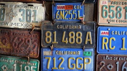
We share the rambling wooden house with 6 climbers from El Paso, the house decorated with broken down appliances, salvaged and antique items and old number plates.
The next morning we return to the Pie-O-Neer cafe, a whole morning passes as we sample the Cherry, the Blueberry and the Coconut cream pies chatting to the endless stream of customer that come and go. It takes all our determination and will power to cycle away that afternoon.
Antelope Wells NM to Silver City NM
We’re the only ones at the border, the Mexican border guards half heartedly pat our panniers, inspection over and wave us on, immigration appears oppitional but we want to exit legally and bother the offical by demanding an exit stamp.
Tim, the cycle friendly offical on the American side welcomes us warmly, we chat about bikes, New Mexico and the tour divide race. Our welcome to the States includes free Dr Peppers and ice creams, we sign the wall of Tim’s trailer before we roll away. Tim also tells us to have a chat with Vera in the post office in Hachita the next town up the road.
The start of the Great Divide cycling route, only 2711 miles to Banff and with a strong tailwind we roll across the flat plains of New Mexico soon clocking up 26,000km.
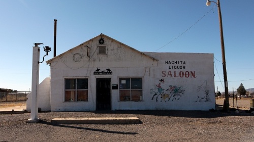
In Hachita, we roll into the post office, Vera welcomes us with a broad smile and we tell her a little about our journey. To keep us rolling Vera gives us a huge raspberry struesel cake, girl scout peanut butter cookies, crackers, soda and plenty of water, we sign her book of cyclists and recommence our battle with the wind that is now a bitterly cold headwind.
To Separ we ride 7 miles against a 50mph headwind, painful memories of Patagonia flood back as we struggle along at a mere 5mph. Exhausted we roll into Separ to discover it’s a ghost town, only a shop selling candies, coffee and odd trinkets remains, but it’s good enough for lunch and enough to get us through to Silver City.
After Separ we ride dirt again, at first a slow gentle climb but then more undulating, steep climbs and fast descents, golden grasses, green yuka trees and large ranches where cows roam.
Before long we return to tarmac and ride into Silver City around lunchtime, riding around looking for somewhere to eat a cyclist hollars, ‘are you going to Alaska?’. Well, ‘yes we are but how did you’, I’m a friend of Wills let me take you up to his place. At Wills we are shown our guest house, we’ll stay here for a few days, waiting for our maps to show up.
Creel to Antelope Wells
In Creel we stay at Hotel Real de Chaltepec, our large room with seating area and open log fire cost about $16 per night, bargain. We revive tired bodies at the Hospital para Crudos, translated this means hospital for the hungover and their spicy soups, stews and burritos would certainly have been the perfect hangover cure.
We spent time chatting with David Lorig a cyclist from the States who is riding around Mexico before heading back north to ride the few remaining states he has not yet cycled.
North from Creel it’s flat again, golden agricultural plains and distant mountains. Rushing straight for the border, we’ve opted to ride the Great Divide, a tailwind pushed us along, the kms tick along nicely.
Again Mexican hospitality stuns us, riding through endless apples orchards we roll up to a lone house, after explaining our journey and asking for a spot to camp we end up in the house sleeping warm tucked up in bed.
Long arrow straight roads devoid of shoulder keep us listening nervously for passing traffic, lorries and long distant buses razor by. This is not the kind of riding we enjoy it’s simply a game of counting down the kms.
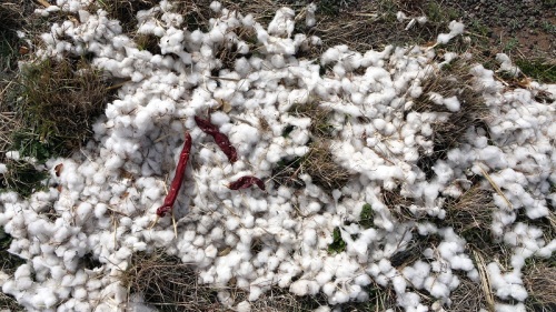
The roadside looks like its christmas time, decorated by white cotton and bright red chillies.
In Galeana we pause looking for a spot to camp, an American accent asks if we need any help and we set about explain what we’re up to. Before we know it we’re having spicy fish tacos with a family of kind Mormon who let us camp in there backyard.
Before the border we stop for a farewell meal of spicy burritos, we’ve really enjoyed our time in Mexico, the people have been incredible, we’re sad to leave.
A faded wooden sign for the USA points us in the right direction as we head towards Antelope Wells, the quietest of America’s 43 borders crossings with Mexico.
Samachique to Creel via Urique
After being warmly welcomed into their home Buz and Kathie treat us to elk stew, chocolate pudding and hot chocolates while we tell them about our adventures and they tell us about their missionary work with the Tarahumara Indians, the local indigineous population. That night we sleep snugly in our own log cabin with blazing wood fire, forever our thanks and gratitude to Buz and Kathie.
Overnight temperatures drop to -7 and we wake to inches of snow. While we ponder our options Buz and Kathie ply us with pancakes smoothered in maple syrup and coffee.
We decide to stay on the backroads hoping the snow will vanish as we lose height, our route takes us to Urique via Cororachi, Cienguta de la Barranca and Gualapina. As we roll away in the snow our tyres scrunch and slip, the first few kms are flat giving us precious time to accostomise ourselves to ridding loaded touring bikes in the snow.
And then we began to climb steeply, our tyres struggling for grip, Sylwia falls twice hurting her leg and elbow, a few cuts and bruises, luckily no broken bones. The sun begins to shine, the sky now its usual brilliant blue, the snow slowly melts falling from the trees, a slushy torrent of water runs down the track.
Descending in a spectacular, steep and narrow river valley towards Cororachi the temperature rises and the snow slowly recedes, now back on dusty dry tracks the snow of the morning far behind us now.
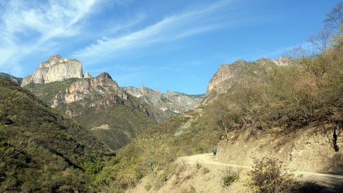
Then begins a series of climbs and descents as the road cuts a spectacular course through the rugged mountainous Copper Canyon. Progress is ponderous and slow but that only allows us time to stop and stare in amazement as views unfold at every corner.
Stopping at one rocky ledge looking back at the snow capped peaks we’ve come from we notice some ancient rock art under our feet.
The local Tarahumara women dress in brightly coloured flowing dress wrapped up in hand knitted blankets to protect from the cold while the men wear nothing but loin cloths , loose brightly coloured shirts and open toed sandals recycled from old car tyres. The local indigineous indians are incredible runners and this is their traditional dress, in the local ultra marathon they often beat the worlds best.
Eventually we see the canyon floor far below, buildings nothing but a small speck, a narrow track clings to the mountain side weaving it’s way down. The track is rocky, loose and steep, controlling our loaded bikes takes strength and concentration. Descending the air becomes warmer, the climate drier and cacti replace pine.
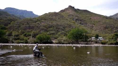
At the bottom we push knee deep through the chilly waters of the Rio Urique and make the final 6km up river to camp at Entre Amigos.
We spend two nights at Entre Amigos, the campings a little overpriced but we stuff ourselves with greens picked fresh from the organic garden and chat with the runners off the up coming Caballo Blanco ultra marathon.
The 20km up to the canyon edge is a tough slow slog but gradually Urique recedes below us and by lunchtime the cacti and heat are gone.
We eat avocado tortillas looking back at the road we cycled down on the opposite side of the canyon a few days before, Urique far below, now among gently swaying pine trees.
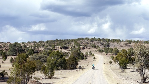
Riding among pine trees, the road undulates steeply, the track corrugated and rocky. We pass through communities of Tarahumara indians where women still wear traditoinal dress, their homes simple wood or mud brick buildings.
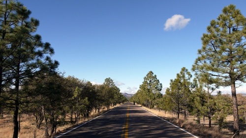
Taking local advice we follow the flatter road via Cuiteco, a narrow single track follows the railway and a stream, gradually gaining height, rock formations tower above us and pine trees scent the air.
We eventually return to tarmac, passing El Divisadero we stop to stare at the wonderful views of the canyon before rolling into Creel in time for a second breakfast.
Durango to Samachique
After 3 days in Durango staying at Fridas we pry ourselves away to continue our journey north. Frida welcomed us into her home and treated us like a long lost friends, it took effort and determination to leave the luxury and comfort of their home.
The terrain is dusty and barren, sun bleached golden grasses stretch to the horizon where distant mountains tower, this place really feels like the wild west and has been the location of many John Wayne movies.
Leaving the tarmac the roads are all but deserted, we climb up a dry canyon towards the silver mining town of Navidad. Stopping to get directions we’re told to back track for 7km to take the alternative road as the road ahead is blocked but other tells us it’s passable by foot so we carry on descending back down to the river rejoining the main road.
Away from the river the track passes through rolling mountains and tall rocky outcrops, we pass a few dusty barren towns of surly cowboys and happy kids.
Leaving the main road at Villa Ocampo flat golden agricutural plains blur into the distance, cows graze lazily in the fields as cowboys corral their livestock into pens ready for market, it’s mellow relaxed riding and the kms click by unnoticed.
Oddly In the distance silvery green trees stand tall and proud fed by rivers that lazily flow across the road, some shallow and easily pedalled others a cold bare foot push.
The landscape changes suddenly, small gnarly old oak tress jutt out of the rocky terrain, the road climbs and descends endlessly in and out of the steep river valley and the winds begins to torment us.
Rejoining the main road we head towards the Copper canyon, the climbs get longer, the altitude higher and pines trees carpet the mountains. The wind is now brutal, a cold bitter headwind reminds us of our struggles in Patagonia. The wind, the sworn enemy of cyclists, a remorseless unrelenting force that saps strength and determination.
Leaving the mainroad we descend into Samachique, the last few hours snow has been threatening, the clouds grey and ominous, a few flurries here and there. Samachique is home to some American missionaires and as we cycle by a cheery couple wave at us and after a few tentative questions about camping in town they ask us if we want to come in and warm up with a hot chocolate, we immediately take them up on their offer.
Zacatecas to Durango
Our favourite ride in Mexico, although a short one it’s deserving of it’s own entry. We are not the first to roll this way, we’re following in the tracks of others before us, thanks go to Tom and Sarah and Cass.
After a short blast on the highway out of Zacatecas we soon pick up the back roads that’ll take us nearly all the way to Durango.
Passing through flat golden patchwork fields and dusty deserted pueblitos of mud brick houses, the contrast to cosmpolitan Zacatecas is vast.
Yukka trees cluster on hillsides in what appear like small communities, these odd trees are one of the few things growing in this arid and dry landscape.
The flat agricultural plains give way to rolling mountains as we climb into a sprawling canyon.
The ride is quiet and tranquil, an occasional pickup trundles by, the distance between towns has increased and we are all alone. We found some of the best camp spots, serene and peaceful amoung the trees and cacti, just the occasional call of a wild coyote for company.
Rolling into a dusty pueblito unsure of the way to the next town, there’s a group of men supping corona. Normally this is the type of crowd we avoid but from among the throng one shouts a greeting in a lilting American accent and we cautiously stop and ask directions. Despite our protests we’ve soon been treated to some cokes, hamburgers, chips and leave our panniers bulging with litres of water and a family sized bag of crisps. Once again we are stunned by the kindness and genourousity of Mexicans.
Again trying to minimise time on the highways we detour onto some more back roads camping at the local Balanerio and visiting the El Saltito waterfall.
Oaxaca to Zacatecas
2184km already in Mexico and we’re starting to got a feel for it. Leaving Oaxaca we begin searching for methylated spirits for our stove, locally called alcohol industrial. After asking at every ferreteria (hardware store) for 20km and embarking on a wild goose chase we eventually stumble across some at Comex. At first the guy stares demused at Sylwia suggesting that she should be buying alcohol at the supermarket. We persist, explaining its not for drinking but for cooking, oddly this doesn’t clear up matters so in stuttering Spanish we explain it’s for our stove and leave with 2 litres, enough for a few 1000kms.
The road north from Oaxaca despite being marked as a main road on our map is almost devoid of traffic, enroute to Teotitlan it cuts through cacti covered mountains, deep rocky canyons and forests of pine and oak.
Avoiding Mexico city we plot a route north of this huge city, our only aim to avoid the busy main roads. The area is surprisingly flat, a patchwork of golden fields stretch to the horizon, a series of dirt and pot holed tarmac roads take us through barren agricultural towns.
The mornings are cold and misty, the sun a glassy orb soon warms the air, by mid morning we ride under blue cloudless skies.
Ridges of mountains seperate large expanses of flat land, the climbs and fast descents come as welcome relief from the monotonous flat straight kilometres.
Occasionally our route planning goes a little wrong. Trying to avoid the main road our maps shows a smaller dirt road, this comes to an abrupt stop but two old gents suggests following the canal and then cutting across the fields. Sounds good, well it wasn’t, the canal is full of raw sewage, a fetid rancid smell hangs in the air. The thick sludgy liquid pours through irrigation channels and into the fields of crops, later that day we pass a huge dam full of sewage, maybe this is a unique solution to Mexico’s water shortage?
Often we’re camping at Pemex service stations, it’s not ideal but with the chance of a shower and good coffee it could be worse, other times we’ve hidden among the cacti and watched as the sun slips below the horizon and the lights of distant towns illuminate.
Mexicans are kind, outgoing and generous, the acts of kindness and goodwill already to numerous to detail. But this one standouts, huddled at the side of the road stuffing biscuits on a cold damp morning a local pulls over and asks about our journey, the usual questions but he gets it, leaving he shoves 20 pesos into my hand telling us to warm up over a coffee at the next service station.
Mexican border to Oaxaca
Viva Mexico!
The first 1000km of Mexico pass quickly. Originally we planned to cycle both the rugged Mexican mountains and the great divide cycles route in the States but with only 6 months remaining and over 12,000km ahead of us we’re facing up to some diffcult decisions.
So soon after Antigua we have no desire to visit another colonial town so a series of quiet backroads takes us through dry scrub desert and dusty towns with mud adobe brick houses as we avoid gringo hangout San Cristobal de Casas.
Soon sprawling sugar can plantations dominate the landscape, lorries overloaded spill cane on the road, sticky sugary water makes the road sticky and a burnt sickly sweet sugary smell hangs in the air.
As we cycle Mexicans amusingly shout random American phrases, hey dude, what’s happening man, how y’all doing, what’s up! But more importantly they’re quick to offer hungry cyclists leftovers.
Our first night camping we salivate as delicious smells waft our way from a local families BBQ, probably seeing the hungry look in our eyes they soon offer us a delicious helping of garlic prawns.
Wanting to avoid the main road up to Oaxaca we spy a faint line on the map and happily head into the mountains, as we climb Patagonian strength winds batter us tossing the bike around like a rag doll.
Chatting to 3 men who studiously survey our route one utters something about ‘conflicto’ and another suggests it’s too late to head higher into the mountains and leads us back to his humble home where we camp in his homemade church as he recites passages from the old testament.
Further questioning confirms trouble has flared up in the area ahead, an armed conflict over drug plantations, so in the morning we descend 55km back to pick up the main road, oh joy a 110km detour!
Since Quito, Ecuador we’ve not seen or heard of other cyclist but now they’re rolling past on a regular basis, all going South of course but at least we’ve got someone to share stories about the road ahead with.
Now higher in the mountains the terrain is dry and dusty, short scrub trees, golden sun bleached grass and thousands of cacti cover rolling mountains.
A sweet smell lingers, patchwork Agave plantations cover the slopes and families distill Mexcal in shacks at the roadside. We pull over to get a closer look and are given a guided tour and walked through the 10 day distillation process, it’s still morning but we cannot get away without sampling a shot, the locals are adamant it’ll make us ‘mas fuerte’ for the climb ahead.
With Mezcal powering our legs we soon reach Oaxaca via the Arbol de Tule the worlds stoutest tree and crash out at Tamaras, our latest and probably greatest warmshowers host.
Despite the negative media and our trepidations about entering Mexico the land of violent drug cartels we’ve been greeted by strangers as if long lost friends and been shown kindness and generousity unheard of in Europe.
Guatemala
The little countries of central america are passing quickly, we’re collecting passport stamps as regularly as punctures, we continue our journey northwards.
We’ve timed our arrival in Central America well, for the first two weeks the backend of the wet season soaked us daily. December though is the start of winter and also oddly the dry season, temperatues are at yearly lows and we ride under cloudless blue skies, the air high in the mountains cool and refreshing.
The riding settles into a regular pattern, climb, descend, climb, descend, no sooner have we gained 1000m than we are speeding down again, it’s like riding a roller coaster in slow motion so we have time to look to wonder and to understand a little about life here.
The worlds most popular bean, coffee is important here, plantations bright green cover hillsides with red beans vibrant and ripe, locals work with wicker baskets on their back a thick band around their forehead holding the preciuous cargo of coffee beans in place.
Old men hunched over, the daily task of collecting and carrying wood for heating and cooking has taken a heavy toll, again the same technique band around the forehead, neck straining to support the bundled wood on their back.
Unlike the rest of Central America Guatemala doesn’t appear to have drinkable tap water. So Ladies, posture perfect, broad and strong collect the days water in brightly painted containers, 20 litres balanced on their heads, they gracefull, purposefully stride a noisy throng of children in tow.
And once again here in the mountains ladies young and old wear colourful traditional dress.
The views a constant of rolling mountains, perfect cone shaped volcanos, pine clad hills the air lightly scented, areas cleared for grazing or haphazard rows of golden sweetcorn disappear into the distance.
Antigua, the old capital of the country, abuzz for new year celebrations, wide cobbled streets, crumbling earthquake ravaged churches and brightly painted colonial houses.
Everyone takes to the streets, fireworks and bangers boom and echo and the beer flows. Local men wearing bizarre constructions dance through the streets the throng parts like the sea as fireworks and flares spray from their constructions whipping the crowd into a frenzy.
Wanting to avoid the busy PanAmerican we head towards San Adres Itzapa home of Maya Pedal, we don’t stay, instead we take a dust horse track high into the hills, as dusk descends we roll into Patzun and gratefully roll out thermarests on the floor of Bomberos.
A steep, sweeping descent thourgh pine forests, along a valley bottom means only one thing a long crawl back upto the 3200 where the wind blows Patagonian style, the drizzle and low cloud add gloom reminiscent of an English winter and the temperatures plummet, we huddle in a cheap Comedor, hands cupping pipping hot coffees.
At San Cristobal Totonicapan we rest for 4 days with Carl of warmshowers, aside from a list of never ending chores and ongoing repairs we climb Santa Maria and watch in awe with childlike grins across our faces as the volcano far below erupts.
Again avoiding the busy PanAm like many riders before us Carl shows us a back road up to Momostenango from where we take a series of ripio tracks through the mountains. Gruelling climbs and rough rocky decsents on dustry dry tracks take us through pine forests where brown needles blanket the ground, golden dry grasses sway and little mountain villages punctuate the route.
The rest of Guatemala passes on the PanAm, a descent through coffee plantations, beans dry by the roadside the acidic acrid smeel of fermenting beans hangs in the air, we pass the border smoothly and roll into Mexico, only three countries to go now!
Honduras
Through Honduras we continue at full speed, Copan Ruinas our Christmas stop is getting nearer but mountains loom ahead. In the absence of an xmas tree we take to decorating our bikes, but we still don’t feel particularly festive, the sweltering heat and lack of family at this time of year is peculiar.
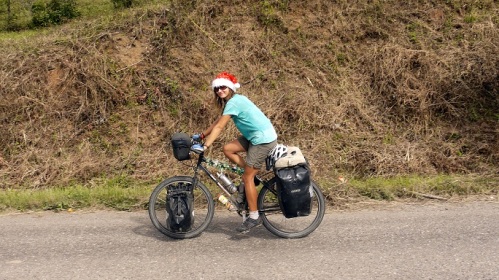
To spread some festive cheer we ride in a Santa hats handing out sweeties to the poor children we pass brings broad smiles, the simple joy of giving.
We climb and blast through the capital, two kids on BMXs tail us swerving in and out of traffic smoothly bunny hopping curbs.
Taking to Ruta Lenca the terrain is dry and golden, pine trees scent the air and the road climbs high where the air is cool. Indigenous towns where live spills on to the street, noisy and chaotic reminiscent of Bolivia.
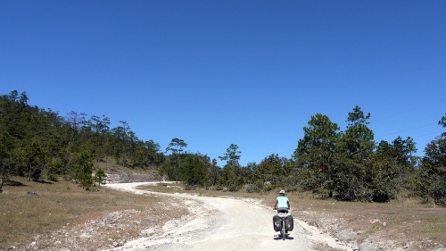
The road now deteriorates, nothing more than a boulder strewn track, beautiful, picturesque, quiet, high up into the mountains passing through small indigenous communities.
We’re now sadly accoustomed to terrible driving but here in Honduras it’s been taken to a new level. Overtaking around blind corners, undertaking, forcing cars off of the road, sadly luck runs out for some and we see two accidents just before Christmas. Machisimo and driving don’t mix, locals drive with beer in a cooler safely secured by seatbelt in the passenger seat, the driver a little drunk without seatbelt, there’s only one outcome here but at least he didn’t spill his beer.
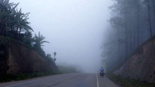
Some long days, pre dawn starts, cool fresh misty mornings and tired legs, in need of a rest we arrive in Copan Ruinas midday on the 24th.
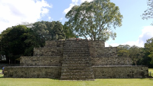
Copan Ruinas is a toursit hotspot and for Christmas we ate delicious food and soaked tired muscles in the nearby thermal springs, boxing day starts with pancakes and maple syrup, we then wander slowly around the Mayan ruins.
Happy Christmas
Our second Christmas on the road, this time we’re sweltering in the tropical heat of Copan Ruinas, Honduras and doing our best to be festive despite the lack of snow and freezing temperatures.
In the absence of a Christmas tree we made do and decorated our bikes and have been riding wearing our Santa hat and handing out sweeties to passing kids.
Happy Christmas family and friends we miss you all very much.
Nicaragua
At some point something had to give, Alaska is still thousands of miles away and we’re running a little late so wanting to explore Mexico and the States we crank up the miles.
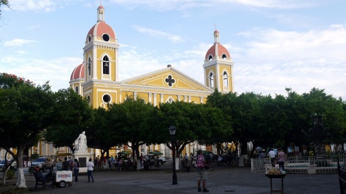
Nicaragua passes in a blur, 4 days and 381km, we take a day off to wander around the colonial splendour of Granada. Faded crumbling brightly painted colonial buildings, shady tree lined plazas, cobbled streets.
The wet humid jungle is now behind us the scenery much drier. Golden sun bleached grasses sway, short scrub deciduous trees rustle and big eared cows graze barren fields as we roll through the foothills.
Cycling gives us time to glance, to look, to see, to understand. Nicaragua is clearly poorer than Costa Rica, existence is hand to mouth, ramshackle wooden houses, cooking over open fires, scrubbing clothes by hand, fetching fire wood, life’s a daily struggle.
A man waves to attract the attention of passing motorists, in his hand a long stick, a procession of baby parrots bob up and down squacking in union another beckons, trying to sell a pair of dead Iguanas.
But our bellies are happy, the food is surprisingly good, the portions generous and the handmade juices simply delicious, a favourite sweet chilly and tamarind.
San Jose to Nicaraguan border
With one of the worlds most active volcanos smouldering nearby we again head to the hills wanting to get a closeup view of volcano Poas, climbing we pass through vast coffee plantations but the obscuring clouds remain low.
The clouds descend, a bitting wind chills the air and drizzle begins to soak we ride on as the day closes in searching for a place to stay. Out of the gloom three cows wander down the road, a voice asks what we are doing, we explain our situation and soon find ourselves accompanying Chiry back to his house. A hot shower later and we are sat around his table chatting, drinking agua dulce and eating home made sausages, we sleep contently in his workhouse.
Working out way towards Lago Arenal we again hope to catch a glimpse of Volcano Arenal, on route we zoom through hot humid lowlands, tropical fruit plantations stretch endlessly towards to horizon and gigantic Iguana scurry for cover as we roll by.
The local tourist office tells us to stick to the main road, only horse can pass but being keen to take the road less travelled we ignore the advice. Others have been this way before and the first 10km pass, a well graded ripio road provides occasional glimpses of the lake but the gloom and drizzle resmebles a bleak British autumn day.
Be carefull the rivers strong the locals warn, after two hours we’ve heaved all out kit across to the other side a narrow muddy boulder strewn tracks heads into the distance.
The next 20km takes 4 hours, involves very little riding, plenty of pushing, lots of mud, hoardes of mosquitos, deadly snakes and absolutely nothing of interest to look out, the busy road to the north is looking more attractive by the second.
Towards the end of this self inflicted torture we skid to a stop, the primevil scream of a howler monkeys echos and familiar black silhoutes swing through the trees, we stand mesmirized, enthralled as a family of monkeys pass by stopping to look down upon us.
Returning to the Panamerican it’s a Sunday and devoid of traffic we blast along the coastalbreeze at our backs resting for the night in Liberia at Posada del Tope an old colonial building filled with antiques, old bikes decorate the garden.
From Liberia we plan to loop back into the mountains, crossing from the pacific to atlantic watershed before finally crossing into Nicaragua, big thanks to Cass Gilbert for the route details.
A blinding white dusty track in places cut metres deep into the hill side lifts us high above Liberia.
As the road continues to climb we enter dry forest, a succsesion of false summits pass and the road narrows down to nothing more than a dirt track, perfect.
We begin to descend and in a moment dry forest gives away to dense, wet, humid cloud forest. Bright green vegetation crowds the road, exotic birdsongs echo from the tree tops, snakes slither across the track, lazy sloths slumber and howler monkeys chant demonically.
Approaching Colonia Blanca clearings appear, cows graze,the narrow track widens a little and signs of people increase. Passing through the small settlements of Colonia Dos Rios and Brasillia we emerge back on tarmac.
Dispatching the last few kms we again spend the night at the firestation this time in La Cruz, now it’s only a short hop to the border and country number 9.
Panama border to San Jose
With time to kill until the all important meeting with the American embassy in San Jose we dawdled along the Costa Rican coast. Mileages dropped, we meandered, wandered beaches and relaxed.
In Palmar Sur, again searching for free lodging we chanced upon three nuns at the local chruch, the kind sisters welcomedus warmly, provided us beds, a shower and food and chatted telling us about their work.
Leaving the coast behind we begin the slow climb towards San Jose. Unlike the gentle graded climbs that dominate the mountains of South America the road builders of Central America make no such concession, the road climbs and descends at insane gradients and we sweat, curse and grind up and down.
Scenery changes, palm nut plantations of the coast replaced by dense moist rain forest until this finally gives way to cleared pasture land where cows graze between tall swaying pines, a cooling mist hangs in the air.
4th Dec 2011 marks a landmark, a year ago we left Ushuaia Argentina, nearly 20,000km have passed to mark the occasion we indulge treating ourselves to a massive pizza and litres of Coca Cola, we spend the night once again tucked up in bed at the firestation, this time in Santiago De Puriscal.
Marko and his wonderful family let us surf their couch in San Jose for 3 nights, we wander the city, eat fast food replace our stolen cycling shoes and Sylwia gets her Visa to the States, now for some riding, but what route do we take through the states.
Panama
It’s got a canal, this obvious and slightly dull fact was all we really knew about Panama, we also expected the riding to be equally and unrelentingly dull and the weather to be unbearably hot and humid.
We began our cycling in Central America with dismally low expectations and it turns out aside from a few non cycling highlights are expectations exactly matched the reality. The canal didn’t disappoint, it was after all a canal and some impressively large boats slowly manouvered through the locks, but it hardly goes down as a highlight of our trip, it is after all only a big canal.
The weather was awful, searing unbearable heat and stiffling humidity, clothes soaked in sweat then sudden torrential downpours soaked us through.
What did surprise us is how American Panama looked from the road, out ot town shopping malls, fast food joints, designer brands, bill boards they even have drive through banks, are we really so lazy we cannot be bothered to get out of our cars to use the ATM.
The Police provide us accomodation and occasionally food for 4 nights out of 6, when asked why they help instead of shoving us towards the nearest hotel they proudly said we’re here to serve and protect, overwhelmed all we can do is offer our gratitude.
Stumbling slowly ever closer, emerging from the watery heat haze a runner, soaked in sweat, crumpled water bottle in hand, ripped worn out clothing, quickly cathing his breath Tony explains in his coarse Irish accent he’s running around the world.
Holy cow!, we’d heard about people like this, doubted they really existed but now we are stood chattering with an around the world runner his battered body testimony to his punishing journey. We feel humbled, after all we’re only cycling to Alaska.
To read more about this incredible, inspirational man check out his blog. http://www.theworldjog.com
After months living on rice, beans, chicken and fried plantain the discarded fast food wrappers and bill boards showing juicy burgers tempted us, we sat in cold air conditioned luxury greedily devouring a big mac meal.
We’re not ashamed to confirm it was simply delicious, we are a little ashamed to admit we could have eaten 1 or maybe even 2 more.
Sailing to Panama
Thanks to Meg and Jules we sailed in luxury on Buon Vento from Cartagena over to Puerto Linto in Panama. For the first 24 hours we endured rough seas and all looked a little green but as we approached the San Blas islands we entered paradise.
An Italian captain and chef meant great food, plenty of alochol and great company.
Through the San Blas islands the local Kuna indians fished in small wooden dug out canoes selling us fresh lobsters, crab, octupus and red snapper.
Nicolino the chef worked miracles and helped restore our battered bodies to full health.
We lounged in the sun, swam in warm Caribean waters, snorkelled amoung reefs watching an underwater world of brightly coloured tropical fish, star fish and felt our hearts jump with fear as giant stingrays and sharks swam by.
But for the first time in a year we felt isolated, insulated and removed from the communities and environment we where travelling through.
Views on Colombia
For months we’ve heard only good things about Colombia, the people are great, the ridings amazing but unfortunately this is not the Colombia we found, but with such expectation maybe there was only ever going to be disappointment.
The riding compared to the other countries of South America has been no better than ordinary and at times simply dull and tedious especially when we’ve had to venture on to the dangerous, traffic choked and polluted main roads. It’s not that the ridings been bad, it’s been pleasent, nice and enjoyable but that’s it and that’s the problem cause the other countries have simply blown our minds.
The only sections that compared were the incredible, rugged, rocky ride from Pasto to Mocoa and the quiet country tracks between Suesca and Raquira. And the mountain villages of the Santander province stunned us with their simple colonial splendour.
While there have been many acts of stunning generousity and overwhelming friendliness these have more than been out numbered and over shadowed by the amount of times people have tried to con us, rip us of, take advantage of us or simply lied to us.
But we’ll never forget the people we’ve meet like Edison and Marcela, we knocked on the door of what we thought was a small roadside military post looking for somewhere to pitch our tent. It turns out it was their home and fledgling paint ball business, we spent the night improving our awful Spanish, learning a little about the culture and people of Colombia and playing dominos. Before waving us of they cooked us breakfast and gave us energy drinks for the road.
All in all Colombia’s our least favourite country we’ve cycled in South America.
Bogota to Cartagena
Bogota is notorious for many things but it’s dedication to promoting cycling is a shining example to the world, on Sunday morning the city centre is shut to traffic and cyclists get to ride unmolested through the streets.
Leaving Bogota we soon picked up one of the main cycleways, 27km later we stood on the outskirts of the city ready to battle the heavy traffic and toxic exhaust fumes.
Leaving the main road at Zipaquira we sought out a litte peace and solitude, unfortunately the area has many small coal mines and a steady stream of trucks rumbled by coating us in a mix of exhaust fumes and dust. Past Suesca the road returned to ripio, the traffic vanished and golden fields of corn, farmsteads and rolling hills spread far to the horizon.
Steep rugged climbs led to sweeping grin inducing descents taking us first through the artesan town of Raquira, resplendent with it’s brightly painted buildings and then onto the colonial splendour of Villa De Leiva.
Arriving the weekend before local elections election fever was in full swing shattering the normal tranquility of the town. Competing supporters dressed in matching tshirts rode horses or drove through the streets, a cacophoney of horns, music and shouting ruined any notion of a peaceful break.
We pondered their passion for democracy but eventually agreed it was down to the free beer which had been flowing freely since early morning.
With heavy overnights rains, this is the rainy season after all we arrived splattered in mud at Marta’s in Moniquira but after a quick washing session we enjoyed a good evening with Miguel Angel, Marta and family.
A nondescript blast along the main road took us to San Gil where we again took to the small roads and hills to see Barichara, reputedly the most beautiful town in Colombia.
The Colonial town is picture perfect, white washed walls, cobbled streets, terracota tiles and neatly painted wooden doors and window shutters, and best of all very few tourists venture up the hill.
After treating ourselves to sweet bread and avena casero at the Panaderia on the plaza we took a small dirt track and descend to the raging river far below.
In the hot sweltering heat we regained all our lost height and more occasionally hiding in the thorny bushes as locals herded their cattle up and down the road.
With the locals of a tiny mountain village refusing to allow us to camp at the school we cycled towards the dusk eventually finding a lovely family that allowed us to pitch our tent on their verdana, we ate dinner in the cool mountain air and watched as the lights of Barichara twinkled in the dark on the other side of valley.
The pattern of long cooling descents and grinding hot climbs continued through La Fuenta and onto Zapatoca where the clouds descend coating the town in a fine cooling mist.
The last climb before Giron has recently been tarmced but is still incredibly steep and in the energy sapping heat seemed to take an eternity. At the top an undulating wet sand road cut through pineapple, papaya and madarin plantations.
For the last 10km we battled lorries and the organized chaos of south american roads works before reaching Giron. From Giron we opted to take the main road straight up to Santa Marta as we wanted to get to Tayrona National Park on the 3rd Nov to celebrate Sylwia’s name day.
There is not really much to write here so we’ll summarise 4 days into a few lines.
It was hot and humid sweat pored from every pore and our skin prickled, trucks coated us in dust and exhaust fumes and torrential rains soaked us through swelling rivers, flooding huge areas of land and washing away peoples homes. We passed through shabby sun baked towns, endless banana and palm nut plantations and watched vultures circle overhead and in a frenzy greedily devour roadkill.
After 4 days we reached Santa Marta, clocking up 562km including a new trip record of 171km in a day. Our cyclists sun tans have now reached new levels of absurdity, hopefully a few days on the beach in Tayrona will help.
Tayrona national park protects a beautiful strip of coast, white sand beaches bordered by coconut palms and tropical jungle, crystal clear warm waters and huge white granite boulders.
Cold fresh water mountain streams from snow miles above cut through the jungle and down to the beaches where crocdiles lazily linger watching the locals cast their fising nets.
Over night thunder storms crackle and boom clearing and cooling the hot sticky night air.
From Santa Marta it’s a short flat blast along the coast to Cartagena, the heat is oppressive the straight road’s a watery blur at the horizon cutting between the alantic ocean and the estuary of the mighty Rio Magdellena.
Stopping early in morning we wallow in the mud of Volcano Totulmo, floating suspend in the sticky warm mud it’s impossible to sink but your brain cannot overcome the fear of sinking especially knowing the bottom is over 2500m down.
Mocoa to Bogota
From Mocoa buttery smooth tarmac glistens under heavy torrential rains as the road cuts through lush dense green jungle and up and down rolling hills. Hot and humid we sweat uncontrollably, heavy brooding clouds bring torrential storms, lightening crackles and thunder booms.
Slowly the terrain changes, gone are rolling jungle hills replaced by flatish valleys and rolling green pasture, the road lined by coffee and cacoa plantations and amazing bearded trees.
From Neiva we take the backroad on the Eastern edge of the swollen Rio Magdelena to the quiet town of Villa Vieja before cycling into the semi arid Desierto de Tatacoa.
To our eyes Desierto Tatacoa looked like a small version of Parque Nacional Ischigualasto in northern Argentina and the other Valle de La Lunas that we cycled through in Bolivia and Argentina, that’s to say incredible.
Bizarre rock formations, a cooling breeze and the potential of great star gazing tempted us to the natural pool and campsite at Penon de Constantine. After a 3km dusty track and rickety bridge crossing the friendly owners welcomed us with a glass of homemade limonade with panela.
We lazed in the cooling pool, swung idily in shady hammocks and watched the glittering stars of both hempisheres.
Two maps clearly showed a road following the Eastern edge of the Rio Magdelena through Suarez and joining one of the main highways into Bogota.
Things started well, a near deserted road took us away from the arid desert and cacti into a flatish farmed valley. A shady tree lined road speckled with sunlight took us through small settlements where locals lounged in the shade playing dominoes and slurping cold beers.
Then suddenly the road ends replaced by a narrow track, we ride and push in blistering midday sunshine. Now the only company is herds of cows and men on horses, we ask about the route ahead and get waved onwards, estimates on the time to the next town ranges from 2 to 5 hours.
We cross rivers, some we simply cycle through grateful for a soaking in cooling water others require a little more effort.
So far Colombian hospitality has been incredible, arriving in the small village of Tamirico we head straight to the school, locals are busy making tamales, soup and chorizo for a festival the next day and ply us with soup and tamales before finding us a sheltered place to camp.
As soon as it had stopped the road begins again and crossing more rivers, through green pastures and past large haciendas we emerge back on the main road to Bogota.
Two days of climbing takes us up to cold and wet Bogota.
Colombian border to Mocoa
After 2 frustrating hours we leave the Ecuadorian border control, with fingerprints taken and 90 day visas we stroll out of the Colombian border control within minutes and headed into the chaos, noise and traffic of Ipiales in search of a case de cambio.
Taking a short detour we descend to Las Lajas and its famous church, a neo gothic building wedged into the bottom of a steep gorge with thundering river.
After taking the Panamericana to Pasto we detour east. The Pasto to Mocoa road has become something off an adventure cyclists must do and was rocky, tough, wet and tiring, everything we wanted.
From Pasto to the Valley of Sibundoy the route is mainly tarmac and although hilly is nothing more than a gentle warmup for the next section. Stopping in San Francisco, Edison and Marcela offered us accomodation, entertainment and a hearty breakfast.
From San Francisco to Mocoa the main road between two provincial capitals is nothing more than a rocky, wet, muddy single track lane that crosses rivers as it snakes its way through dense jungle covered mountains.
Often no wider than 3 metres and with a sheer drop to one side the road has rightfully gained the name trampoline of death, roadside shrines and crosses are a grim reminder and line the roadside.
At the last pass the views unfold, tall mountains give way to flat jungle, a river meanders slowly towards the ocean and the road zig zags its way down the mountain side.
Hot and humid, sweat drips as we cycle the last few kilometres on tarmc through banana trees and past brightly painted wooden house into Mocoa.
Views on Ecudaor
Ecuador, our smallest country so far but one we’ve been looking forward to for some time. Compared to Peru, Ecuador is a little more developed, a little more civilised, gone are the constant shouts of gringo, shabby shops have been replaced by well stocked supermarkets, service stations line highways but prices are a little higher and oddly we’re now using the American dollar.
All too often the spectacular views have been covered in cloud, hidden from view, we cycled along the avenue of the volcanos head to toe in gore-tex, occasionally though the cloud lifted and provided short glimpses of the magnificent snow capped volcanos.
Although small the country offers a glimpse of everything that is great about South America, friendly warm locals, snow capped volcanos, hot humid jungle and beaches if you head that way. Our highlights are, the backdoor border crossing and days struggling up and down steep dusty roads to Villcabamba, the Quilotoa loop, Cotopaxi national park and El Angel reserve. All in all the cycling has been great, the people friendly and welcoming just a shame the weather was so British.
Quito to the Colombian Border
We wave a sad farewell to Mum and Glenn and restart our journey north, we’re calling it Part II.
Santiago welcomed us into his home and treated us like one of the family, an incredible man, an incredible family our meagre gifts cannot express our true gratitude.
Picking up the old railway line we cycle through deep gorges, hand worked fields, rural villages, dark tunnels and over rickety bridges before being deposited back on the Panamerican highway with it’s noise, pollution and heavy traffic.
Briefly stopping at the other equator monument we snap a few photos before rolling north again but this time in the northern hempishere.
At Cayambe we detour east heading through rural villages and patchwork fields worked by hand, high above snow capped volcanos occasionally can be glimpsed through the low grey cloud.
Rejoining the Panamericana at Ibarra we climb in the searing sun upto El Angel, the views of the valley below and snow capped peaks in the distance become more impressive the higher we climb. The Bomberos in El Angel provide a bed, tv and hot shower and a little less impressively some dodgy directions that result in us climbing 13km and 700m unnecessarily.
Back on track a cobbled road takes us high into the otherworldly reserva el angel, a rare Polyepis plant grows here and covers every inch of the high altitude paramo.
The narrow cobbled road, peculiar plants and low heavy cloud combine to make this a good days riding. As the rain starts to threaten we’re invited into a local peasent families home and sit by the wood buring stove eating and chatting as the heavy rain deluges outside.
Back on the Panamerican it’s a quick blast to the border, the chaotic Ecuadorian border takes hours to pass through but within minutes our finger prints are taken by the Colombian officials and we enter our 6th country.
Climbing Cotopaxi
Little by little the alur of the mountains has tempted us and having passed so many we resolved to climb Cotopaxi, the worlds highest active volcano and apparently a safe beginners mountain.
Lying in bed, trying to sleep in the Refugio at 4810m we listened apprehensively as the wind howls. Starting at 1am, bleary eyed we head out into the pitch black, head torches blazing, piercing a tunnel of light in the gloom illuminating the falling snow.
Slowly making progress, legs tired, lungs heaving for oxygen the wind picks up and snow and ice sting exposed skin forming a frozen crust over our waterproofs, hats and gloves. The fresh fall of snow has covered the normal trail, route finding we sink knee deep in fresh snow, the extra effort quickly sapping our energy.
Around halfway an ice collapse transforms the apparent walk into a terrifying technical climb, in the pitch black we jump crevasses, walk narrow ice bridges and climb steep ice faces.
The wind picks up nearly blowing us off our feet, ice particles sting our faces and one of Matt’s eyes developes frost bite as he becomes tempoarily blind, his eye an icy translucent white. Only an hour from the top we make the tough call to go back down fearful of losing sight in another eye.
With nerves jangling Matt fumbles with frozen fingers through his pockets pulling out a hand scribbled note, what a place to propose, exhausted we return to the Refugio engaged. Our guide a veteran of 651 summits say the conditions have been the worst of the season, we’re deflated we didn’t make the top, what a terrifying adventure but most of all we’re delighted to now be engaged.
Matt’s Mum and Glenn in Ecuador
Abandoning the bikes at Santiago’s, the popular Casa de Ciclistas in Tumbaco we spend a couple of days chatting to Tom and Sarah two fellow cyclists and attempt to complete our never ending list of repairs.
16,116k have passed beneath our wheels and this represents our halfway and time for a little rest.
Stood waiting at the airport, the automatic arrival doors slide open and shut as each new passenger greets family and friends, we wait impatiently for Mum and Glenn. Oddly feeling nervous but also incredible excitement, soon Mum and Glenn amble into view, Mum looks healthy and well what a recovery from less than a year ago.
Quito, a few days exploring the old city wandering the sites allowing time for Mum and Glenn to acclimitise to the altitude and attitudes of South America.
Losing 1500m in height, we arrive in Mindo, damp moist cloud forest clings to steep hillsides and clouds obscure the forest canopy.
The region of Mindo is home to more bird species than the whole of North America and a chance encounter with Randy (www.zerodegreeslatitude.com) soon has us walking the local trails necks cranked back, eyes scouring the trees. A twitchers delight we spot brightly coloured exotic birds, listen to frantic bird calls and end the day watching a turkey vulture flying overhead with a wrything snake hanging from its claws.
We also find time to visit a butterfly farm, an orchideria, a chocolate factory and a midnight frog concert.
Crossing back and forth over the equator we visit the Mitad Del Mundo, our first time back in the northen hempishere for many months, we are now egg masters having balanaced an egg on the head of a nail an oddity permitted by the weak gravity on the equatorial line.
Otavalo, the famous indigenous market, a sprawlig mass of colour, noise, texture and people leaves us exhausted but with bags bursting with souvenirs.
Ecuadorian Border to Quito
Dragging the immigration officials away from their mid-morning coffee and interupting their idle chatter our passports gained their 5th country stamp and we ducked under the bambo pole that marked the border and entered Ecuador.
Rolling green mountains reared up in front of us, a steep dusty rocky road disappeared into the vegetation, the oppresive humidity sapped strength and sweat dripped as we started the first of many lung busting climbs.
Reduced to the occasional push progress slowed as the road carved its way through steep mountains covered in thick green vegetation and through little mountain towns with brightly painted wooden houses.
Cocao and coffee dried roadside and camping on a families lawn we spent the evening shedding the husks of coffee beans and then drinking the home roasted beans, an insight into the simple life of rural Ecuadorians.
Again climbing high we left the hot oppresive humidity behind us as we entered the high cloud forest. Water gushed along the road side and waterfalls fell from craggy rock faces, clouds closed in rushing low across the hillside obscuring views, chilling the air and coating us in water vapour.
Approaching Villcabamba the terrain turned barren, golden patchwork fields decorated mountain sides and golden dry grass swayed in the cooling winds.
We spend 4 days in Villcabamba, not a traditional Ecuadorian Sierra town, an oddball collection of beatnik Americans have moved South creating a peculiar little town. While in Villcabamba we tried Vajra Guru Mantra, free of charge lessons and the desire to try out something completely new and far removed from our lives at home tempted us to leave the relaxing campsite at Rumi Wilco.
After so long without rain Villcabamba and it’s afternoon thunder storms signalled we had cycled into an unseasonally early rainy season.
From Villcabamba we hit the Panamerican, a road we’ve avoided like the plague up until now but with Matt’s Mum visiting in Quito we had a little distance to make up. Staying high in the mountains the road continued a familiar pattern of long descents followed by energy sapping climbs, not on the scale of Peru but still significant.
From high in the Paramo, rain and low cloud would drench us until a freezing, hand numbing descent delivered us back into warmer lands. Afternoon rain meant we kept the waterproofs handy as low cloud blanketed the views obscuring the snow capped volcanos that line the road north of Cuenca.
Having made up some time we detoured from the Panamerican towards Laguna Quilotoa, a huge collapsed and flooded volcano crater high in the Sierra mountains. The route took us back into remote rural scenery miles away from the heavy traffic, pollution and urbasiation of the Panamerican highway.
After the laguna the road clung to the cliff side, dusty and rocky passing through a land of craggy gorges, towering mountains and through mountain towns were kids chased us down the road as they made their way home from school.
As we descended the scenery became green and lush, cows grazed in fields and forests clung to impossibly steep mountain sides, the road a sinuous strip of tarmac steeply climbed past the twin Volcanos of Illinizas and back up into the high cold barren golden sierra before a final descent deposited us back on the panamerican with its roaring trucks and toxic exhaust fumes.
From Quilotoa we immediately headed east leaving the noise, pollution and people that crowd the Panamerican behind to cycle through the Cotopaxi National Park. A volcanic ash road led us through pine trees and streams until the park entrance where we camped under the shadow of the worlds highest active volcano.
Being so near to the Equator the rise and fall of the sun varies little, darkness descends around 6.20pm and the sun lightens the sky around 6.20am. Like most cyclist we co-ordinate our sleeping pattern to this natural cycle so awaking early to a perfect blue sky we were delighted to have our first glance of the Volcanos.
Instead of thermals we now ride in shorts and t-shirts bathed in srong equatorial sun, we slowly climbed up onto the barren, bleak but stunningly beautiful paramo, Cotopaxi standing tall and proud, the perfect snow capped volcano.
On a whim we hitched up to Cotopaxi car prak at 4500m, sat in the back of a 4×4 we strained and clung to our bikes as we bouced and bumped up the rutted rocky track. With fresh snow roadside and bitting winds we added layer upon layer and rolled down the worlds tallest active volcano.
From the park we descend back into a greener world, lush forests and plants hung over the narrow cobbled road and cows grazed in lush green pastures, a great ride and luckily mainly downhill for us.
In the distance urbanization sprawled to the horizon and we rejoined the chaos of the main roads towards Quito heading to the Casa De Ciclistas in Tumbaco to meet Santiago our gregarious and friendly host.
Views on Peru
Talked about for months on the road, from grim warnings to glowing priase, it’ll blow your mind, toughest riding ever, you cannot survive without GPS profiles, it went on and on but more worryingly warnings of hostile locals and robberys played on our minds.
What emerged, the reality was a little different, friendly people, curious, interested and welcoming, our initial fears soon disappeared. Only the constant calls of gringo that followed our every pedal stroke could be construed as rude but we simply smiled and waved hollering a similar greeting in response.
The soaring mountains and deep valleys are unmatched, bewildering and mind bending, exceeding expectations and challenging mental and physical reserves. An amazing diversity of climates and terrains; we cycled through high barren frozen altiplano, sticky humid hot jungle, bewildering tropical glacial mountains, sprawling exotic fruit plantations and off course spectacular Inca ruins.
We’ve really enjoyed our time in Peru, are sad to be leaving, we’ve been challenged physically and mentally but seen wonderous Inca ruins, jaw dropping mountains, lush exotic jungles and stark barren altiplano.
Huaraz to the Ecuadorian border
From Huaraz the road descends through the famous Canon Del Pato, 39 tunnels over 50km as the road cuts a precipitous path along a steep gorge. The roads in poor condition and the riding slow, dust hangs in the air, the occasional dark long tunnel involves riding blind our feeble bike lights struggling to penetrate the darkness.
For many months stories from the road have told of robbery at gunpoint around Trujillo so wanting to avoid losing our beloved bikes we decided to take the road less ridden and stay in the mountains all the way to Ecuador. This section has been the most difficult riding in
Peru, a combination of poor ripio, crazy gradients and searing heat reduced us to occasionally pushing. Alongside the obvious physical challenge some days are mental torture, the road carves up and down impossibly steep valleys, riding all day we struggle to hit 50km, still able to see the town we left that morning only a few km’s away as the crow flies.
The area is home to some of the worlds largest gold mines, while providing much need income and jobs the economic benefits come at considerable environmental cost. Entire mountains are destroyed in the search for gold and many others in the area are already scarred marked out for future destruction.
The route took us through areas largely untouched by tourism, quaint mountain towns with picturesque plazas, ornate churches and white washed buildings with wooden balconies.
Shouts of ‘Gringo’ are standard fare in Peru but in the quiet mountain town of Mollepata the old lady running the only shop in town managed to cram the a bewildering 17 Gringitos into one sentnces while all around collapsed in fits of laughter. With cold drink in hand I wander out, a grin plastered across my face laughing out loud and slumped in the plaza sheltering from the midday heat ready to tuck into another tin of Fanny tuna.
Outside Cajabamba the terrains greener, rolling hills, wooden fences, cows grazing, milk churns decorate the roadside, mornings are misty, a white haze hanging, drapped over the hills, slowly lifted by the searing high andean sun.
Long descents take us into a different world out of the cold brisk air and barren mountain terrain, exotic fruits grow, temperatures high, hot air blasts you like that of a hairdrier set to max. The valleys are hot, humid, oppresive, sweat drips, mosquitos hum, nights are restless. Taking a day off the bike we wander around the incredible ruins of Kuelap.
Entering the Amazonas region the world is green again, lush, huge vegetation crowds the roadside, the air, hot humid and oppresive, lungs struggle for oxygen heaving in the warm damp air, after so long in the Peruvian mountains this is a dramatic and welcome change.
Roadside shops now sell biazarre exotic fruits, sugar cane and provide us shelter from the fierce midday sun. The road meanders along a wide flood plain, rice growing in paddies neatly terraced and irrigated under looming green mountains.
Now back on a popular cycling route we pass many cyclists heading South and run into Hideki, a Japanese cyclist heading north to Alaska. The route rolls up and down, coffee and cacao dry roadside, we pass through little villages, clocking up 15,000km we eventually reach the Ecuadorian border.
Riding around Cordillera Blanca
We have spent the last five days riding around the Cordillera Blanca, the worlds highest tropical mountain range and reputedly one of the most beautiful in the world. The views of stunning glaciers and snow capped peaks from Huaraz and Colin’s glowing description tempted us into the mountains for a little adventure.
From Yungay the route looped around the Cordillera Blanca for 250km and took us over two high mountain passes including the 4890m Punta Olimpica
Leaving Yungay a rough ripio road snaked up through mountain villages for 30km until the glacial lakes of Llaunaco, where we camped wild by a burbling melt water stream, it’s source, a hanging glacier high above. High above us the road zig zagged up to the first pass.
Cycling down the road wiggled past small glacial lakes, under snow capped peaks and glaciers until the small town of Yanama. Never flat a series of descents then ascents followed river valleys to San Luis and then higher still to Chacas.
The villages of this region were originally settled by Italians, resplendent churches and monastries, terracota tiles, white washed walls and ornate carved wooden balconies give a feel of Tuscany.
The climb up to Punta Olimpica stretched high and far into the distance. Away from the villages along a river valley, past the tree line the landscape barren, glacial morrain and rock scrapped bare. As snow flakes fluttered down, the snow line far below, legs burning around the last few steep and rocky hairpins we made Punta Olimpica at 4890m, a spectacular view of the Cordillera Blanca all around.
Descending in the bitterly cold air, fingers and toes numb, splashing through glacial melt water, we left the snowy mountains behind, a green valley far below, only a series of jaw dropping hairpins to go.
Leaving the Cordillera Blanca behind we reflected on this great ride and quickly concluded that this was one of our all time favourite rides, we cannot recommend it highly enough.
Visit to SOS Children’s Villages in Huancayo
While on the road we’re supporting the international charity SOS Children’s Villages who provide a loving home for orphaned, abandoned or abused children. In Huancayo, Peru we got the opportunity to visit one of the villages and to see first hand their incredible work. It was an emotional and rewarding afternoon.
The village provides a home for 108 children, there are 12 houses where a mother looks after 8 to 10 children. Not only is the charity providing a home they create a true family unit and the mother looks after the children like her own 24/7, the love, care and support was a joy to behold. The charities role does not end there, they provide the children with an education, food, clothing, healthcare and equip them with all the social skills need to succeed in society.
Further to this the charity provides services to the community with the wider objective of preventing children being abandoned. They provide day care, schooling, health care and meals to children of single parents preventing these children being abandoned. They also run a number of outreach programs in the community aimed at educating parents to improve quality of life and again prevent abandonment of children.
The work of the charity transforms the lives of children, giving them a chance and hope for the future. All the children we meet were happy, content, polite, courteous, smart and welcoming, it was a pleasure to spend time with them in their homes and participate in their educational games.
The problems faced in Peru and Bolivia are staggering, poverty is rife, birth rates exceptionally high, children suffer malnutrition and physical and sexual abuse, are forced to work, beg on the streets or forced into the sex trade from a very young age. There are many more children that need help, we are hoping that if you read this you may be kind enough to donate.
To provide day care for a child costs 33p or 50 cents (per day) in American, for a staggeringly small amount you could help prevent a child being abandoned. For only £80 or about 100 dollars a month a child is given a loving, caring home, this small amount includes, housing, eduaction, medical, clothing, food and all other costs and most importantly a mothers love.
To find out more please follow the link below, should you want to sponsor a child then this is also possible and makes a great way to help directly. Click here for our English donation page Click here for our Polish donation page To find out more about SOS Children’s Villages click here To sponsor a child click here
Cusco to Huaraz
“Dude, it’s aweseome, the shit in Peru is going to blow your mind, dude, awesome.” “Have you got the profiles, the elevation profiles, the GPS data, you cannot ride Peru without it?”
Leaving Cusco, La Estrellita and our new cycling friends we stood on the edge of the feared Peruvian mountains. Climbing out of Cusco, the splendid grandeur of the Colonial and Inca centre faded replaced by poverty and slums.
The pattern for the next 19 days was soon set, climb 50kms, descend 50kms, climb 50kms, descend 50kms or something similar and repeat for 1300km or so. Someone with GPS tells us we’ll have climbed 21,300m by the time we reach Huaraz, nervous, excited, apprehensive, an understatement I think!
Descending down to just below 2000m, the eyebrow of the Jungle, it’s hot and humid, dense green vegetation clusters the road, bananna, papaya, lemons, limes, grenadina and lucuma grow in exotic fruit plantations. The narrow road clings to steep cliff sides contouring alongside wide meandering rivers, tiny zuccodos deliver painful itchy bites and we move aside as huge lorries fill the narrow road.
As we slowly ascend the terrain and vegetation changes, greens turn to golden browns and eucalyptus and pine trees sweetly scent the air. Steep mountain valleys are terraced and campesinos tend the fields by hand while bundles of sweetcorn strung up like oversized Christmas decorations dry swinging from the rafters of mud brick houses.
Climbing higher through the clouds that blanket and shroud the valleys far below we enter the bleak and barren high Puna. Vicunas bound gracefully in the distance and hardy souls tend sheep and make cheese living a tough existance unchanged for centuries in stone and straw huts. The wind cold and fierce wind slows our progress as legs burn and lungs struggle for oxygen in the high altitude air but soon another descent arrives.
The road a mixture of pristine tarmac, pot holled single lane, smooth dust ripio or rock strewn tracks that result in our first blowout. We found roads washed away by swollen rivers, buried deep under landslides and wet and muddy from cascading waterfalls.
The people of the mountains greeted us warmly, ‘Hola’, ‘Como Estan’ , ‘A donde van’, ‘Que pais’ rang out, hollared from the fields, door ways and gardens. ‘Gringo’, ‘gringito’, ‘gringa’ and ‘gringita’, old and young shouted collapsing in hysterical fits of laughter as we cycled by. Technically not a ‘gringo’ we smiled, waved and in our minds replied in kind musing at the locals lack of originality. We slept in mud brick store houses and tin sheds.
Passing through the Huascuran national park and summiting two passes over 4800m we stared at some of the most stunning scenery in Peru, hanging glaciers, river valleys and snow capped peaks.
And the downright bizarre Puya Raymondi plant, apparently a distant relative of the pineapple and the largest Bromelaid in the world.
And yes, the mountains of Peru have so far blown our mind. And yes we do have GPS profiles, one of us likes to know how much further we have to climb while the other would rather be in the dark about the pain and agony ahead but we’d hardly call them essential.
Cusco and around
There are a number of options to get to Machu Picchu from Cusco, we opted to cycle to Ollantaytambo and then catch the train the rest of the way. From Cusco we cycled to Chinchero and then shortly afterwards picked up a series of dirt tracks taking us to the ruins at Moray an Inca agricultural centre.
From Moray mountainous singletrack led us down to the traditional village of Maras and then onto the salt works at Salineras where a salt water spring feeds 1400 salt pans that have been in use since Inca times. The ride satisfied cravings for some mountain biking taking us through great countryside and spectacular ruins.
Taking time to explore Ollantaytambo, the last surviving town built according to the Incas grid system, the town was a maze of cobbled streets, intricate Inca stone work, babbling waterways and Inca ruins.
From Ollantaytambo we took the expensive train up to Machu Picchu, the Inca Citadel defies description so we’ll not try we’ll simply let the photos below do the talking.
Returning via the sacred valley following the cascading Rio Urabamba between flat cultivated flood plains, rugged sheer granite cliff faces, snow capped peaks and glaciers, majestic mountains and Inca terracing. We stopped in the delightful market town of Pisac exploring the sprawling artesenal market before climbing and then descending via more Inca ruins back into Cusco.
Despite being Gringo central Cusco is a great place to return to normality for a while, we sated cravings for roast dinner, pie and mash, curry and beer. We wandered around the streets admiring the colonial Spanish architecture and mortarless Inca stone work. La Estrellita (an unofficial Casa De Ciclistas – Av Tullumayu 465) provided a great place at bargain prices to recover and meet other cyclists sharing stories of the road ahead and during June there are a number of festivals.
Peruvian-Bolivian border to Cusco
With no protests blocking the border we passed through immigration with ease and entered our fourth country, Peru. Two hardy Canadians told of us two young Brits touring, we wondered if we’d meet on the road.
Cycling along the edge of the lake we passed through golden sun bleached farmland where families in traditional dress where busy harvesting and small dusty towns.
On our first night in Peru the two young Brits wandered into the same hotel, the next morning we cycled with only our 3rd cycling partners. The company and stories from the road helped pass the dull tedious miles as we headed away from the lake and towards Cusco.
Climbing away from the lake we reached 4335m, the air cooler but the hot Andean sun and oxygen depleted air had us struggling and sweating up the long slow climb. A few kms from the top a 14 year old on a single speed bike caught us, he was on his weekly commute to school 60km away via a 400m climb only returning home at the end of the week.
Dropping down the valley towards Cusco the scenery became greener, the mountains steeper and rugged, lush farmland irrigated by ancient channels, extensive hillside terracing and pre-inca and inca ruins.
Riding into Cusco wasn’t the splendid entry we expected, choked with traffic, pollution and dust, the driving was the usual chaotic and crazy South America experience but we arrived tired and dirty at La Estrellita (445 Tallamayo).
La Paz to the Bolivian-Peruvian border
Retracing our steps we slowly peddaled back up the Autopista to El Alto. Protests and roadblocks are a stapple of Bolivian life and the road out of El Alto was blocked by stones, burning tyres and rubbish, we passed through with no more than the occasional shout of ‘Gringo’.
With snow capped mountains to the East we slowly left the flat altiplano behind, passing though grim towns we reached the shores of the lake. Contouring around the lake shore we passed ruins and ancient paths before again climbing over 4200m and then descending into Copacabana.
Staying two nights in Copacabana we joined the hordes of tourists and took the slow boat out to the Isla Del Sol. A magical island of pre-inca and inca ruins dotted with picture perfect villages and a multitude of terraced hillsides.
Fortunately the protest that had previously blocked the borders had ended and we peddaled the short distance into Peru. The protestors object to the Peruvian government granting a permit to mine for the Silver on the edges of Lake Titicaca claiming that the mining activity will pollute the lake and destroy acres of farmland.
Views on Bolivia
Bolivia has been the South America we dreamed and wondered about, were anxious and nervous about and has provided unforgetable memories but also the occasional unsavoury incident.
Punched in the ribs while cycling on the first day, stones thrown at us by children, turned away rudely from hostels and had our bag slashed open and then stolen.
But the riding has been memorable, tough, mountainous, beautiful and challenging. Traversing Bolivia we’ve seen high altitude altiplano, hot humid tropics, mind bending salt flats, multi-coloured lagunas, isolated mounatin towns and soaked in natural hot springs. The riding’s been the toughest yet, endless, relentless mountain climbs, terrible cobbled roads, deep dusty ripio and oxygen depelted high altitude passes and lets not forget the absolute freezing cold nights of the altiplane and icy river crossings.
The driving is simply awful, disrespectful, ignorant and arrogant, riding into any town or city is a gamble, a game of dodgems. People, cars, food stalls, fruit and vegetable carts all competing for space, us stuck in the middle, wide eyed and befuddled trying to steer a safe course through the chaos.
Men are generally surly, a little aggresive and unhelpful yet the women are generally engaging, friendly, hospitable and interested. Resplendent in traditional dress, bright billowing skirt, knitted alpaca leg warmers, glittering hand knitted top, bowler hat perched precariously on their heads with pitch black plaited waist length hair. The women, short, stout and strong like a badger can be seen throughout Bolivia working the fields, ploughing, harvesting, collecting food, chopping firewood with their child wrapped in a bright hand knitted blanket tied to their back, men conspicuous by their absence.
It’s sad that we are not sad to be leaving, it’s been an unforgettable experience, a vivid and sometimes disturbing view of life in South America’s poorest and most unequal country, shocking, rewarding, challenging, brutal, beautiful and majestic.
The Death Road
No longer the most dangerous road in the world; a man behind a desk at the World Bank adorned the road this sobering title, now 300 to 400 deaths a year are prevented by the new tarmac road that carves its way up the opposite valley.
The death road drops 3000m from the high snow capped mountains above La Paz to the hot humid tropics at Coroico. At times startlingly narrow with stomach churning drops and drenched by cascading waterfalls the road clings precariously to the mountain side.
Thousands of tourists descend every year, stories of macho men racing downhill and female first-timers make the deaths understandable as the road really is not difficult on a bike, exhausting and tiring yes, technically challenging no. Saddened to hear of a death 3 days before we descended and 28 in total we rode with caution on our rigid touring bikes.
Potosi to La Paz – 01.06.11
Leaving Potosi under foreboding grey skies , Cerro Rico was now covered in a fine dusting of snow. We slowly climbed out of the city, lungs heaving in the oxygen depleted air, legs straining to propel our heavy bikes up the steep city streets.
Out of the city and descending into a deep river valley speeds touched 85kmph, the lower altitudes bought higher tempeatures and sapping humidity. Soaked by warm rain we stopped early asking at a small village shop if we could sleep somewhere, initially greeted with suspicion the lady suggested the health centre across the road but with no one there she took pity on the two soaked gringos at her door and provided us a bed for the night.
Approaching Sucre the temperatures continued to rise, the air humid and moist, the climbs shorter and steeper, the barren mountains replaced by lush green hillsides.
After repeated Gardia infections we spent 8 nights in Sucre at the excellent Wasi-Masi hostel and took advantage of the excellent local health care. The city of Sucre, a UNESCO treasure of colonial buildings, cobbled streets, cathedrals, vibrant markets and picture perfect plazas provided a great place to rest, relax and recuperate.
Having recovered we rolled slowly out of the city bouncing along cobbled streets heading for Cochabamba. Descending into the hot humid lowlands people now everywhere busy working the fields along the roadside. We spent a sweaty hot night in the tent, a dramatic change from the freezing altiplano.
The tarmac vanished, the road now cutting a rocky route up a dry river valley, lorries and buses covering us in clouds of dust that stuck to our sweaty bodies. The cobbled road from Aiquile to Totora pounded our bodies and sapped our strength, hands and fingers went numb, shoulders, arms and arses ached.
Going against the grain of the Andes the descents provided endless grins but the 40km long ascents on cobbled roads, in thick dusty ripio or even on buttery smooth tarmac exhausted bodies and minds. The views were astounding, endless crumpled and creased mountains, deep river valleys the road cutting a sinuous and torturous route far into the distance over another high altitude pass.
Reaching Cochabamba the noise, chaos, dirt, pollution and mass of swarming people, carts, cars and minivans was a startling contrast to the solitude and quiet of the central highlands. We battled through the street market that spills unceremoniously into the road, stalls of exotic fruits, vegetables, electronic goods, socks and pants and clothing providing obstacles to our progress and a miriade of smells from the mobile street food stalls.
This route again took us to high altitudes, the air crisp and cold, the sun glaring and hot, we again spent nights well above 4000m. The highest pass came between Cochabamba and La Paz, a mere 4496m. Descending back down to the flat, barren altiplano populated by bleak unwelcoming towns and over looked by towering snow capped peaks, only the traffic of Ruta 1 stood between us and La Paz 200km further North.
Lorries, buses and cars sped by inches away as we hugged the shoulder choking as the vehicles belched dark clouds of toxic exhaust fumes. La Paz slowly came into view, obscured by a hazy smog and surrounded by snowy mountains, we gawped in amazement as we descended into this sprawling metropolis of 7 million people.
A Bolivian conversation
We’ve become accustomed to getting vague and inaccurate responses to simple questions, such as, ‘how far to the next town’, ‘what is the next town’, ‘is there a shop in the next town’, ‘where’s the bank’, questions that back home would get an accurate correct response but here in South America nothing is so simple.
But here in Bolivia the responses to seemingly simple questions have ranged from ridiculous, absurd, outrageously inaccurate or simply downright wrong. Below are some of our more memorable conversations that have generally left us dumbfounded and non the wiser.
Finding a bank
“Where is the bank?” – Matt
“No there’s no bank here” – Local
“What!, no bank in the town, what about in that direction”
“No” – Local, getting a little agitated at my perserverance
“Ok, but what about that street” – Matt, hungry and needing money won’t give it up
“Yes, there a bank one block away on the corner” – Local, admits grudgingly
How far is the next town?
Having waved down a rare passing car the following baffling conversation takes place high in the Bolivian mountains.
“How far is it Cerrillos” – Matt
“What!” – Driver “How far is it to Cerrillos” – Matt, trying a different prononciation of Cerrillos
“Where?” – Driver
“How far is it to Cerrillos” – Matt, trying a different prononciation of Cerrillos
“What, Cerrillos?” – Driver spraying flecks of chewed Coca leaves in my face
“Yes, Cerrillos” – Matt Lots of scratching heads among driver and passengers
“3 Kilometers” – Driver ”
No, its 35 Kilometers” – Passenger 1
“It’s not on this road” – Passenger 2
Passengers and drivers continue there debate about how far it is to the town they have just driven through a short time ago but fail to agree about anything at all.
“Thanks”, Matt – we leave none the wiser about where this mystery town.
Going out for dinner
Trying to find Dinner in any Bolivian village in the middle of nowhere, for some context we are stood in a shop buying some biscuits and snacks for the next days ride.
“Is there anywhere we can buy dinner” – Matt
“No” – Shop owner, preceeded by lots of head scratching
“What nowhere we can buy Chicken Soup or Spicy Chicken” – Matt
“No, but you can buy a sachet of chicken soup , here you go” – Shop owner, handing us the sachet
“Thanks, but we don’t want a packet, can we not buy dinner somewhere?” – Matt
“Yes, my wife cooks, you can have rice, sausages, chips and salad, come back at 7.30pm”
Grateful and confused we agree to return later for dinner to the unmarked restaurant (restaurant is perhaps to generous a description but it was a room with table and chairs and lots of locals slurping their soups) tucked behind the shop, lesson learned, to get anything in Bolivia simply repeat three times or until blue in the face, getting what you want is simply an issue of perseverence and repitition and no one is more patient and determined than hungry, tired cyclists.
Simple questions get a range of response, these can be classified into three areas. The first is simply incorrect or inaccurate, the local really doesn’t know the answer but will give it their best guess, sometimes this is so stunningly wrong you’ll be dumbfounded. The second is they really don’t want to tell you the answer, for a variety of reason I guess but here all you need is a bit of determination and grudgingly they’ll crack and relent. The last is you’ll get the answer that the local thinks you want to hear, while soothing to your ears and tired muscles this is simply unhelpful and confusing.
Mine Tour – Cerro Rico, Potosi
The abundant silver of Cerro Rico bankrolled the Spanish empire for 2 centuries, using slave labour from first Africa then South America, it is estimated that 8 million died in the mines.
Cerro Rico is know nick-nammed the mountain that eats men. Now 16,000 Bolivans work in terrible conditions underground desperate to provide a better life for their families. Average salaries for miners are good by Bolivan standards, 4000 Bolivianos (£370) per month but still appalling low by Western standards.
1 tonne of mineral ore produces about 150 grams of impure silver making the miners about $60 this is then processed overseas and then sold as pure silver at $47 an ounce. The miners use centuries old manual working practices, mining by hand, using dynamite to expose veins of minerals and moving tonnes of mineral ore by hand.
The average life expectancy of a miner is 10 years, every year there are many deaths due to the complete lack of any health and safety regulations. The miners give offerings to El Tio, the devil, to appease him, to spare their lives and be generous in their search for minerals . Children as young as 12 enter the mine.
A tour of the mine is an unpleasant, shocking and eye opening experience, a glimpse into the unimaginably tough lives of the miners and the people of Potosi. The low wages of the miners and the deadly conditions the miners endure are in stark contrast to the high cost of pure silver and the profits made elsewhere.
To understand more about the lives of the miners watch ‘The Devils Miner’ Uyuni to Potosi Unloading the bikes we made the short trip from Uyuni to Colchani, not able to access the salar proper due to deep standing water at the edges we played around taking photos and stared in awe at this awesome phenonomen.
The Salar is one of two reason to visit Uyuni, the other is Minuteman pizza, a true culinary marvel, masterminded by Chris from Boston he serves up the fantastic pizza and deserts, great coffee and a gut busting all you can eat breakfast that includes pancakes and maple syrup. We spent 4 days gorging ourselves, the 911 heart attack pizza pie followed by chocolate pudding and icecream became a favourite as we carbo loaded for the next stage of our journey north.
Leaving Uyuni we climbed high into the mountains, Uyuni far below in the distance the shimmering blinding white Salar slicing across the horizon. Two passes later we descended into Pulacayo, one of the many mining towns in the region and slowly wandered round the train museum. In the valley far below a ribbon of buttery smooth tarmac showed the route ahead, after 3 weeks on ripio we rejoiced.
After months without rain storm clouds gathered on the horizon behind mountains, lightening illuminated the sky, thunder crashed and strong winds blew, camping in the shelter of abandoned buildings we escaped the rain. The terrain was slowly changing from high altiplano, cacti, deep canyons and sheer rocks faces, llamas, mud brick buildings and Bolivans in traditional dress tending their fields.
Reaching Potosi we gawped in amazement, the highest city in the world, Cerro Rico towering above the city sprawling in all directions. Battling through the chaotic streets we continued to climbed to the old colonial centre.
Villazon to Uyuni
Crossing the border between La Quaica and Villazon was a crazy, hectic, chaotic experience, protestors blocked the road with a giant Bolivian flag, locals smuggled goods across the border and we waited patiently to obtain our entry stamps. The ride into Tupiza, a short blast on a mainly paved road took us from the barren high planes of Argentina into a world of multi-coloured mountains, river valleys and spectacular eroded rock formations.
Butch Cassidy and the Sun Dance Kid were apparently finalled killed by the authorities in Tupiza, to celebrate we saddled up and trotted off into the canyons for a few hours.
The conventional route north from Tupiza would have been directly to Uyuni but with the Salar flooded from unseasonal rains due to La Nina we began looking into alternatives. Keen to see the famed South West corner of Bolivia Julio and Silvia of Natural Adventures (Tupiza – naturaladventure1@hotmail.com) provided details on the route tour jeeps take from Tupiza to Polques and then onto Uyuni.
Despite their ominous warnings, ‘ the roads are terrible’, ‘only 4×4 can take this route’, ‘there’s too much climbing’, ‘ no one rides this on bike, it’s impossible’, ‘its very high altitude and very cold’ we rolled out of town determined.
The 373km took us 10 days, the start was a stark indication of things to come, we climbed over 1500m on rough ripio out of Tupiza and this continued day after day. Everyday was brutal, the climbing was relentless and steep we spent hours pushing and heaving the bikes up impossible inclines and the downhills provided no respite as deep gulleys, loose sand and huge stones made handling our loaded touring bikes exhausting.
But the route took us through a truely spectacular corner of Bolivia, a fantastic alternative to the infamous and popular cycling route past the Lagunas and Geysers of the South West corner.
We cycled past and through spectacular Quebradas, red needle like rock formations, the valley of the moon, the abandoned inca ruins of San Antonio Viejo, shimmering coloured Lagunas, watched as condors soared magestically overhead and gazed in wonderment at crystal clear stars illuminating pitch black night skies.
During the day the blistering high altitude sun warmed the dry altiplano air cracking our skin, lips and drying our eyes. As the sun dropped below the horizon the temperature plummeted rapidly, water bottles froze solid, ice formed on the inside of the tent and on our sleeping bags as the moisture from our breaths froze solid so we slept dressed in thermals, hats and socks.
With snow capped mountains and volcanos visible in every direction and low temperatures all day many times we faced ice strewn rivers, some rideable others an agonising barefoot push, our feet and legs stinking from the freezing waters as ice cracked and broke underfoot.
The route took us into unchartered terrain, an opportunity to see Bolivia untainted by tourism, locals welcomed us, helped us find shelter, provided us with food, stopped to talk with us on the road. This warmth and friendliness was in stark constrast to their tough existence, poverty was clearly visible, families lived huddled together in small single room mud brick houses, no heating, no access to fruit and vegetables, no hot water, no electricity, and mud floors.
Arriving at Polques termal springs mentally and physically exhausted we jumped into the reviving hot springs and ate and drank leftovers from the tour groups at the refugio. Returning to the hot spring late at night with no tourists in sight we enjoyed an incredible starry night, the hot waters insulating us from the freezing night time temperatures.
To exhausted to continue and with Sylwia’s chest infection not clearing we decided to hitch a lift with a tour group, we simply couldn’t contemplate another 8 tough days riding through this barren and desolate corner of Bolivia.
After 7 hours in a jeep we arrived in Uyuni, treated ourselves to pizza, chocolate pudding, beer, a warm bed and a hot shower. To conclude the route from Tupiza to Polques is extreme and brutal, to provide some perspective we both cycled every inch of the Abra el Acay (apparently one of the most challenging routes in Argentina) but on many, many occasions had to push our bikes on this route, the road simply too poor and too steep to ride.
But for those wanting an extreme challenge then this is a great route into a relatively untouched but incredibley beautiful corner of Bolivia.
Views on Argentina
We’re sad to be leaving Argentina; Patagonia, a difficult start, endless pampa, bitting cold and constant winds provided many unforgettable memories. The North has captivated, incredible and unique landscapes, high altitude mountain passes, charming traditional villages and great weather.
The people throughout have been welcoming, warm, affectionate, helpful and friendly. We have been shown heart warming hospitaity and kindness, made some great friends and never felt threatened, uncomfortable or unwanted.
San Antonio de las Cobres to La Quiaca – 14.04.11
San Antonio de las Cobres, a bleak barren town high in the Puna, dusty and desolate, locals cheeks bulging from wads of Coca, glazed vacant looks in their eyes provided a hostel and respite from the cold for a night. Rejoining Ruta 40 we struggled through deep sand and vicous washboard for the next 60km before glimpsing Salinas Grande spectacularly illuminated by the sun as a lightening storm broke in the distance.
The South American Salar company kindly provided bed, food and showers after we knocked on their door looking for a little shelter from the howling wind for our tent. Riding across the Salar was a surreal experience, blinding white in every direction, the salt cracked, creaked and groaned under our tyres. As we rolled slowly towards the horizon tractors ploughed and machines mined the salt.
Leaving the Salar behind we climbed up to 4170 meters through the barren Puna into a world of multi coloured mineral rich mounatins, the cool crisp mountain air scented with the herbal aroma of desert plants. The descent unfolded before us, carving an amazing course down steep mountain sides, a never ending series of hairpin bends dropped us into the UNESCO reserve of Quebrada De Humacha.
35km later and 2000 metres lower we rolled into Pumamarca a pretty little town over looked by the hill of seven colours.
On Ruta 9 we rolled further north ever closer to Bolivia, the road contoured along a river valley slowly but constantly gaining height. Passing through barren cacti strewn Puna, fertile cultivated valleys home to small communities and many spectacular Quebradas of incredible erosions and multi-coloured rocks.
Llamas grazed roadside wandering along the long disused railway. Rolling into La Quica on the Argentine border at the same time as the Rally Argentina that travels the length of the country on Ruta 40 over 14 days we reflected back on the scale of our journey and achievements to date.
Cafayate to San Antonio de las Cobres
4 nights passed in Cafayate, we worked through our seemingly never ending chores, relaxed, visited the local bodegas and tasted some wine, tried some local food and trekked high into the mountains to bath in the cold waters of a waterfall.
Rolling north on Ruta 40 once more the paved road soon vanished and we bumped along on sandy corrugated ripio. Through small settlements of low mub brick buildings we marvelled at the many Quebradas as the road slowly climbed contouring along the banks of Rio Calchaqui.
The mountains multicoloured, jagged and abrupt stuck out of the sandy vertically towards the sky, the road cutting a sinuous and mountains path through this incredible landscape.
Molinos the only significant town on route provide a picture perfect plaza and a shady spot for our picnic lunch. Approaching Cachi the road ran close to the river, through fertile villages were farmers gathered grass and picked onions, the road climbed up and down eventually depositing us in Cachi.
Leaving Cachi at 2280 mtrs the only way was up, the Abra el Acay at 4859 mtrs was a full 3 days cycling away. The road contoured alongside the river passing through vertile valleys, rust red mountains and bizarre rock formations, cacti decorated the landscape and always looming large ahead the snow capped peaks of the Nevado de Acay.
Leaving La Poma in the crisp cold morning air we began another slow day of climbing hoping to get within striking distance of the Abra el Acay. T
he road continued its route along the steepening river valley, often washed away in places or fording the river in others, through green valleys the road wall in by stones much like an English country lane. With the snow capped peaks getting ever closer the road left the valley and began zig-zagging its way up, we camped by the last abandoned building before the summit at 4200 mtrs.
Waking to ice inside the tent and a buffeting wind we nervously ate porridge drunk tea and prepared for a few more hours climbing. The terrain now barren, multi-coloured mountains all around, a few Vicunas for company we began the relentless 12km climb to the top.
Breathing was now very difficult, a lack of oxygen had us panting and stopping every 30 minutes to recover. Arriving at the top with the wind howling we found shelter and ate lunch and marvelled at the zig zagging descent that awaited us.
Now for the reward after all that climbing, carving round hairpins, brakes squealing, tyres squirming, bikes bouncing around, we both grinned like fools as we zoomed through the cool mountain air. The view passed by in a blur as we both concentrated on the road occasionally stopping to gawp around.
At last after 3 days we reached San Antonio de las Cobres, tired, exhausted, dirty but exhilirated having climbed the highest road in Argentina.
Mendoza to Cafayate – 29.03.11
Regaining our strength we rolled out of Mendoza with directions casually scribbled on a scrap of paper, through the sprawling suburbs and surrounding villages and out into the scrub desert surrounding Reserva Telteca.
Arrow straight roads melted into a hazy blur at the horizon, the sun beat down relentlessly and roadside melon vendors provided a welcome sugary treat which we devour like slobbering dogs.
The Diffunta Correa shrine in Vallecito worships a wife who followed her conscripted husband into the desert with her small child, without water she died of thirst but her child survived by drinking milk from her mothers breast.
Throughout Argentina we have see roadside shrines were water bottles are left, the shrine in Vallecito is a huge sprawling collection of model houses, number plates, red ribbons, candles and photos thanking and praising the Diffunta Correa for her help and guidance.
Into Parque Natural Provincial Valle Fertill the scenery changed dramatically, now green and vertile, clouds hung drapped over the peaks of the crumpled, jagged mountains as we splashed through refreshing rivers that coursed over the road.
Altitudes remained between 1500m and 2000m, slow gentle inclines on arrow straight roads returned us back to the dry barren desert of multi coloured rocks, rocks eroded by wind and rain into incredible shapes. Detouring to the Valle de la Luna at Parque Ischigualasto we resumed our Northward journey through Parque Talampaya.
Remaining on Ruta 40 the road returned to Ripio as we slowly gained height towards the Cuesta De Miranda. Through tiny pueblos of mud brick houses were children played barefoot in the street shouting hola as we past and life stops betwen 1 and 6pm for siestas the mounatins closed in around us as the road slowly gained height.
Reaching the pass the the multi-coloured mountains, cacti and fertile river valley far below provided a stunning view. The road clung to the mountain side, we descended joyously gawping at the incredible views brakes stinking hot in the baking sun.
After many weeks without sight of another cyclist we meet two French cyclists in Chilecito and got an update on the road, hearing the next few hundred kms of Ruta 40 described as flat and straight we decided to detour into the mounatins.
Taking Ruta 78 we climbed for hours to Famatina, arriving baked and drenched in sweat from the fierce sun at 6pm the plaza thermometer read 39 centigrade. Gaining altitude we had left the arid desert below and cycled past vineyards, walnut plantations and splashed through rivers swollen by recent heavy rains.
As we left Tinogasta the warning rang in our ears, the road is very difficult, very dangerous, it’s in bad condition from the rains, the sign at the junction for Ruta 3 warned that the road was not passable by vehicle. A slow gentle climb of 35km ran arrow straight to the mountains ahead, a series of switchbacks clung to the mountains side carved into percipitous rocks.
The road detoriated, large rocks, landslides and soft sand, the road washed away in many places, the occasional push and we reached the top. Over the next hour we descended and climbed as the road continuously gained and lost height. With the valley opening up before us a series of rocky hairpins and then a sinuous descent on improving ripio deposited us back into civilisation at Londres.
The Cuesta De Zapata is a fantastic ride, challenging, difficult tough and you need good bike skills but the views are incredible, we reckon well worth the effort and better than a flat easy day on Ruta 40.
After resting for a day we rolled out of Belen and straight into Nicholas a Canada who to our great surprise is also riding North and for the first time since the start of the Carreterra Austrel we roll out of town as a trio.
Back into the arid desert the air is perfumed by desert flowers in full bloom after recent heavy rains we cross river valley after river valley, splash through rivers and often stop to admire multi coloured mountains and weird and wonderful geological creations.
We now often pass small towns, buildings are single storey with flat roofs, large patios are shaded by grape vines and tomatoes, peppers and chillis grow in garden.
Detouring 5km uphill to the the ruins of Quilmes, the city served as a holy city to the indigineous population and is built among towering cacti in the crevice of a hillside over looking the river valley far below.
Mendoza – 17.03.10
We remained trapped in Mendoza for 8 nights, no, not beacuse we were drunk and delirious from visits to the local Bodegas, but instead we were deliriuos with, fever, vomitting and diarhorrea and spent eight days convelascing. We did muster the energy to visit a wine museum and boedga but were left underwhelmed by the experience and frustrated by the drivers and pollution filled city streets.
Mendoza is a sprawling industrial and urban conurbation, the city is pleasent enough with wide tree lined avenues and broad parks, tourism centres around Aconcagua and Wine.
Santiago to Mendoza – 06.03.11
Only a short blast this but worthy of a quick write up as we’re hoping to hang around in Mendoza a while, drink some wine, eat some steak and do some Wwoofing. Pedro a re-known Casa de Ciclistas host guided us out of Santiago from his plush flat in Las Condes, climbing immediately up into barren mountainous desert the change in terrain and scenery was abrupt and stark.
Stopping in Los Andes, Eric Savard another reknown Casa de Ciclistas host and experienced expedition cyclist did the hosting. Following the Los Andes railway we climbed gradual but incesently, leaving the railway an endless procession of gruelling switchbacks stood before us and the Cristo Redentor pass at 3185m.
Stopping at Portillo we camped overlooking Laguna Del Inca tired and aching from having propelled our bikes 2010 mtrs up over only 60km.
After the obligatory lift through the treachourous 3km tunnel we crossed back into Argentina, immediately battered by a brutal headwind we had vivid flashbacks of our time on Ruta 40.
The invernal enemy of cyclist had turned a joyous downhill coast into a grinding chore. Rolling to a halt at Puente Del Inca a natural stone bridge we became instant minor celebrates, posed for photos, fielded the usual barrage of questions and became home video stars.
Passing through the lush and green oasis of Uspallata we spied our first Inca ruins and continued through techni-colour mountain valleys following the cascading Rio Mendoza. Marvelling at shades of burn’t red, orange, and gold we were astound by the barren beauty of this desolate terrain.
We arrived in Mendoza just in time to see the Wine Queen procession and later that evening the 75th Festival De Vendimia. A curious mixture of beauty pagent, traditional and modern dance and ballet all supported by the normal boisterous Argentines who sang, chanted, whistled, danced and waved banners with joyous abandon.
Shame about the complete lack of wine, maybe we slightly misunderstood the concept of wine festival, never mind we’ll get our fill later.
Santiago – 28.02.11
Santiago, the modern prosperous capital of Chile was our temporary home for 7 days, we relaxed, ate and slowly worked our way through a long list of chores. Riding into the city was childs play, with nothing but a few scribbled instructions and a very basic map we pedalled right into the heart of this city of 6.8 million people.
Full of picturesque plazas and parks, manicured lawns, shady palm trees, ornate sculptures and cooling fountains make Santiago a great place to relax and recuperate tired bodies and minds. We wandered aimlessly enjoying the city, visiting Cerro San Cristobel, Bella Artes, Universidad Catolica, Mercado Central, Mercado Vega Central and the Museum of Chilean History.
The fruit, vegetables and food at the Vega had bellies rumbling and we left with a bulging bag of goodies including some prickly pear cactus fruits and fresh figs.
Santiago at 483 meters altitude is surrounded by snow capped mountains, they provide an incredible backdrop for the city but through summer retain smog and pollution obscuring the views as a brownish haze hangs above the city.
Matt even managed to find some time to get in some mountain biking in the mountains that surround the city thanks to our Warmshowers host Pedro who kindly provided a Carbon Fibre Cannondale 29er.
 Sylwia took advantage and spent time relaxing, reading and learning Spanish in Pedro’s balcony hamoc.
Central Chile to Santiago – 25.02.11
Avoiding Ruta 5 we meandered through the central valley of Chile. The area is the agricultural heart of this long slender nation and bellies rumbled as we rolled past vineyards and fields of melons, tobacco, strawberries, sweetcorn, tomatoes and orchards of apples, pears, peachs, nectarines, plums, kiwis, figs and prickly pear cactus fruits.
The smells in the air tempted us and we salivated as we rode, lorries over-flowing with produce rushed by, the roads smelt of dried tomatoes and our tyres stuck to the surface as tomatoes littered the road split from over loaded trucks. We ate healthy road side snacks, melons, figs, grapes, peaches and strawberries.
Devastation from the Earthquake and Tsunami
To understand more about the destruction caused by the earthquake and resultant tsunami we headed up the coast from Concepcion to Constitucion and then onto Iloca.
In Constitucion we chanced upon an excellent photographic display and outdoor cinema documenting the impact on the people and communities of the region, we were startled and upset to learn that 80% of Constitucion was damaged beyond repair and up and down the coast the tsunami swept away homes, businesses and lives.
On the road the extent of the destruction was overwhelming and upsetting, we heard stories of how people ran out of their homes in the middle of night and then watched in the light of the full moon as their homes and livelihoods were destroyed.
The tsunami that followed the earthquake struck before dawn destroying roads, homes, business, schools and communities.
Concepcion 14.02.11
Concepcion, a thriving university city, hub of trade and commerce and Chile’s second largest city was hit by an strong earthquake on the 27th Feb 2010. Measuring 8.8 on the richter scale the quake triggered a tsunami that devastated nearby coastal communities.
Despite the strength of the quake the city remains largely undamaged and miraculously despite the destruction above only 1 person died in the quake with another 450 dying as a result of the tsunami. Government engineers have worked to determine the safety of buildings and as a result numerous buildings now stand empty but the city continues to thrive.
Another quake hit the city on the 11th Feb 2011, despite being 45 km south of the city the quake awoke us, scared and unsure what had happened we quickly realised we’d experienced our first earthquake, we can now conclude our tent is quake proof. Two days later while in Concepcion we feel two after shocks, we admire the resolve of the residents who live in fear of another large quake.
The Chilean Lake District – 13.02.11
Arriving in the lake district via Puerto Montt the contrast between rich and poor was stark, a gignatic cruise liner silhouted over the slumps of the city. Rolling Northwards the 5 star resorts of Puerto Varas, Friutillar, Coique and Pucon served wealth Chileans and rich Europeans.
The rural areas transported you back to an era of German Colonialisation, offering a glimpse of a rural life unchanged over the decades dominated by kuchen, homemade jams, beer and farming.
Slowly rolling north we passed towering smoking volcanos, lakes with black volcanic ash beaches, flat expanses of eucalyptus and pine plantations, broad meandering rivers, rural farmland.
As we continue to roll ever northwards the mileage continues to add up, ticking over 6000km we set about some serious sunset stretching just before a spectacular and scary lightening storm rolled in from the Andes.
The end of summer is now arriving and the days have a predictable pattern. We awake to misty, still, damp and chilly mornings but by midday the sun is strong and the sky blue. Temperatures peak in the low thirties, the tarmac melts and sweat drips and we often take a well deserved break in the nearest shaded plaza.
Islas Chiloe – 01.02.11
Chiloe, Island of myth, legend and magic offered the chance to experience a unique way of life among a proud and independent people far removed from the experiences of the Carretera Austral and mainland Chile.
The Island is famed for its seafood and potatoes, fishing boats large and small all painted brightly decorate the harbours of every town and every inch of fertile land is given over to the cultivation of fruit and vegetables.
To visit Chiloe is to see a way of life that has remained unchanged for centuries. Families grow their own fruit and vegetables and pigs, sheeps, goats, chickens and cows scuttle and roam freely around gardens. As we cycled families worked together collecting grass for winter from fields and bulls pulled loaded carts down ripio roads.
26th Janurary – Coyahquie to Chaiten
Leaving Coyahquie the scenery slowly changed, the green and lush rolling alpine mountains with valleys coloured red, white, purple and blue by thousands of Lupins in full bloom where gradually replaced by thick, wet, humid rainforest dense with vegetation.
The weather transformed from brilliant sunshine to constant and unrelenting rain, water cascaded from the mountains in numerous waterfalls and rivers and we cycled accompanied by the ribbets and croaks of thousands of hidden frogs and toads as rain drops soaked our waterproofs.
Villa Amengual was having its annual festival and rodeo and we decided to stop for a better look as locals flocked for some drunken revelery.
The main event was an odd affair that enthralled the locals for hours despite the heavy rain, this involved two wild horses being tied to a post, brave or drunk (perhaps both drunk and brave or should that be foolish) local men would then mount the horse. When untied the men would whirl a leather whip around their heads beating the already agitated the crazed horse into a furious stuppour encouraging it to buck, bolt and jump in a demented attempt to unseat the rider.
Some horses unseated the rider with spectacular ease throwing the rider to the ground within seconds, others failed and charged around until exhaustion allowed their riders to gracefully dismount, whatever the outcome the efforts of rider and horse drew wild cheers, applause and laughter from the enthralled crowds.
Our clothes remained damp and wet for ten days solid as we throughly tested the waterproof claims of our gear, all regretably failed. The clouds hung low in the damp air clinging to the hillsides obscruring the view in every direction adding to the misery and gloom of riding this section of the Carreterra Austral, the constant trickle of southbound cyclists reported similarily grim tales of rain from Puerto Montt south.
Reflecting back on our south bound leg on Ruta 40 (Argentina) its incredible that only 150 km to the East are the desert towns of Tecka, Gobernador Costa, Rio Mayo and Perito Moreno, part of the flat pampa desert that hardly ever sees any rain.
At Parque Nacional Queluat we abandoned the bikes to see the hanging glacier Ventisquero Colgante, our efforts through muddy jungle rewarded by incredible views of this U shaped river of ice suspended hundreds of metres above a lake into which two fierce waterfalls cascaded.
The Termas El Amarillo located in Park Pumalin (founded by an American philanthropist and one of the largest private parks in the world) is a naturally occuring thermal spring, being only 25km southeast of Chaiten this would be the symbolic end of our journey north along the carreterra austral and a chance to rejuvenate tired bodies before crossing to Chiloe and then heading north to Puerto Montt and the Chilean lake district.
The Carreterra Austrel has been a journey of two halfs, the first from Villa O’Higgins to Coyahquie was one of brilliant sunshine, numerous glaciers feeding cascading waterfalls and rivers, shimmering lakes, snowcapped mountains, alpine forests, mighty rivers, rural famsteds and quiet abandoned roads roamed by wild horses and cows.
The second half from Coyahquie to Chaiten has been one of constant unrelenting rain, low cloud obscuring all views, wet and damp clothes, humid damp rainforst, water all around, flooded valley plains, cascading rivers and waterfalls and sections of busy tarmac road that have now forever changed this section of the Carreterra Austral.
But for the last day the sun shone and revealed the true beauty of this region as snow capped peaks shadowed dense rainforest below, this could be cycling paradise.
Notes from Chaiten
Chaiten was once a thriving port town that in May 2008 was destroyed by a huge Volcanic eruption that covered the town and surronding area in millions of tons of volcanic ash and rock.
The population had been evacuated, afterwards the government encouraged the towns inhabitants to resettle elsewhere by offering payments of $1000 for 18 months, a few people stayed and now the resettlement payments have ended more people are returning.
Belatedly on the 9th Decemeber 2010 the government agreed to restore electricity and water and now more people are returning as shops, hosterias and restaurants open to service the tourists who come here to catch the ferries to Puerto Montt and the Island of Chiloe.
Due to the lack of government support graffitti proclaims, bienvenido a la zona cero, cero agua, cero luz, cero apoyo, in english, welcome to zone zero, zero water, zero electricity, zero support.
There are still many problems to overcome, the course of the river was diverted and now bisects the town, schools are closed, many roads remain buried under metres of ash and the majority of homes lay in ruins.
14th January – El Chalten to Coyahquie
For Christmas we indulged in some luxury and took a room in hostel Infinito Sur complete with hydro massage bath to sooth the aching legs. We rested, relaxed and ate lots venturing out for the occasionally short stroll upto the Miradors of Cerro Torre and Fitz Roy.
El Chalten, Patagonia’s youngest city formed by the Argentine government in 1985 following Chiles unsuccesful claim to the land is an odd outpost that comes alive during the short tourist season. Too often battered by howling winds and driving rain the town is a great place to spend a few days while the sun shines.
Having earlier ridden Ruta 40 south we returned North via the infamous Lago Desierto – Villa O’Higgins route. This involves a 40km ride from El Chalten to Lago Desierto which is crossed by boat then a 7km uphill along a narrow trail and then a 8km gravel track down to Lago O’Higgins which is again crossed by boat before a short 6k into Villa O’Higgins.
Online this route is variously described as the day from hell, the hardest day ever etc etc, its seems to have attained mythical status so we were all a little nervous as we crossed Lago Desierto. After passing through the Argentine frontera we began pushing our bikes up the first track we spotted, following a ridiculously narrow track we heaved bikes over fallen trees, pushed through dense bushs cutting legs and arm, pushed 3 a bike up impossible steep inclines.
After 4 hours the track vanished and we spent the next 2 hours trying to find it again, belatedly it dawned that we’d followed the wrong track so returned to the Frontera a little embarassed, we camped watching the sunset over mtn Fitz Roy.
Waking aching and exhausted from our ‘practice run’ we set off on the real thing, it was tough, we pushed through deep gulleys, carried bikes over rivers, and slogged through wet bogs.
While difficult our practice run was harder but more importantly comparing this difficult day to the 5-8 day alternative that is Ruta 40 this is childs play, a walk in the park, an option that I would not hesitate to recommend to anyone. After the crossing we camped at the farmsted at Candillera Mancilla amoung wild strawberries eating freshly baked bread and eggs before catching the ferry to Villa O’Higgins the next day.
The Carretera Austral has more than lived upto its reputation, a sublime cycling route that defies description. The road cuts though Andean mountains, along river valleys and lakes, under glaciers resplendent with cascading waterfalls, through alpine llenga and pine forests and hot humid sub tropical lowland forest and out into the rocky peaks of the patagonian desert.
The air is scented by alpine pines, lupines, clover, daiseys and various other flowers adding further to the majesty of this great road, without doubt the highlight of our journey so far.
Since resuming our ride we’ve been literally wheel to wheel with other cyclists, except for the fact everyone else seems to be going the other way, south. So far we have passed 71 touring cyclists, since the 4 th December, more than 2 a day, on one day alone 11 Italians crawled past us uphill.
The characters and stories from the road are diverse, from the young French couple who on a whim bought a tandem to crazy Hugh and Pauline who proudly represent the older generation.
It is always the Italians who amuse us most, their GPS devices, route profiles, matching lycra outfits, designer sunglasses expensive perfumes, no expense spared in the pursuit of glamour and good looks. No picture, sorry, we’ll get next time we see a cyclist.
22nd December – Starting our journey North
Despite being the height of summer in Ushuaia the temperatures have plummeted since we left a month ago and snow dusted the roads to Tolhuin as we caught the bus back to San Sebastian.
Restarting riding we were once again battered by the fierce Patagonian winds only managing 15km on the first day before submitting to restart our battle once again at dawn. Before Porvenir we once again admitted defeat and spent the day with Carlo the Gaucho having coffee, talking, riding horses, herding cows and slaughtering sheep.
At the start of the ride I would have considered catching a lift cheating, like many other touring cyclists do but now I believe that these moments are all part of the adventure and only enrich the experience.
From Puerto Natales we took the scenic route through the Torres Del Paine national park avoiding the tourist traffic, the route climbed and descended constantly slowing our pace but this enabled stare in amazement as views unfolded at every turn in the road.
Stowing our bikes we planned to trek the ‘W’, as lonely planet states this is a must do but after 3 days our shoulders ached our feet were sore and the weather closed in so we cut the ‘W’ short and headed back to our bikes.
The ride through the national park is the absolute highlight of the trip so far and provided views that surpassed those we found on the ‘W’ and compared to walking for us cycling is a much more preferable means of transport. The bikes do the hard work of carrying the luggage, you travel at a reasonable speed in greater comfort.
Leaving Chile we rejoined Ruta 40 with some fear and trepidation after our last experience and planned to head to El Chalten for Christmas before crossing over to Villa O’Higgins. At a remote outpost we meet 4 other cyclists who confirmed our worst fears that El Chalten had no bank or Casa De Cambio so once again we cycled into El Calafate.
After the usual Argentine issues getting cash and exchanging currencies we pedalled out of El Calafate after two days mentally prepared to fight the winds all the way to El Chalten.
The 220km into El Chalten will live long in the memory, a ritual of rising at dawn, fighting the strengthening wind until it over powers us and then sleeping until mid afternoon when the wind has died a little before cycling until late into the evening.
The knowledge that this was the last 220km in the fierce Patagonian winds and the thought of riding the carreraterra austrel kept us motivated as we pushed on at less than 10kmph for 2.5days.
During the first two months of our trip we meet only Frans on the rode but having resumed our adventure at the height of the cycling season we are now virtually wheel to wheel as we cross Tierra Del Fuego and Patagonia.
On one day we saw 17 other cyclists zoom past propelled by the prevailing winds and so far in El Chalten we have seen 7 cyclists in less than 2 days. Simply put we no longer feel special but are glad to see so many cyclists and get useful info on the road ahead. The picture below is of two cyclists just completing their 17 month adventure from Alaska to Ushuaia, a scary vision of our future-selfs.
And lastly Mum is now at home being well looked after by Google Man and is well on the road to a full recovery.
2nd December 2010 – Returning to the start
Mum has shown incredible strength, courage and bravery and will shortly be discharged from hospital to return home, she is an example to us all and reminder to make the most of now, we all love you Mum.
Sylwia and I have now returned to Ushuaia the symbolic start of our ride and will resume as previously planned. Going north we will avoid retracing our steps along Ruta 3 or Ruta 40 and will instead head to Punta Arenas and Chile.
Stopping at the Parque Nacional Torres Del Paine to do some trekking before crossing Lago Desierto for Villa O’Higgins and the start of the Carreterra Austrel. That’s as far as the plans extend, as we have discovered trips such as these have a way of naturally evolving as you progress.
29th Oct 8.35pm – Everything changes
Chatting to Fernando the campsite owner who is preparing a traditional Argentine BBQ, Sylwia looks up from our laptop and calls me over, from the tone in her voice and pale look on her face I know something is seriously wrong, my mind spirals out of control as a shamble over.
Some words don’t properly register but others burn clearly into my mind, my legs feel weak, my stomach sick and the world beyond the laptop blurs.
Reading my brothers e-mail again my Mum has suffered a bleed onto the brain and is currently in the Intensive Care Neurologoical unit of Southampton Hospital. The worst thoughts flood my mind, tears fall onto the table below, Sylwia holds me tight as I shake, the next 36 hours as we return to the UK are the worst, time passes painfully while our minds subject us to unbearable torture.
Our cycling is now on hold, our family at the forefront of our thoughts, we will stay at home as long as we are needed.
Notes from the end of world
Famous for being the most Southerly city in the world Ushuaia was our home for a week, like many other Argentine tourist resorts the town has grown without boundaries and without any coherent planning as people flock seeking their fortunes. The centre is an assortment of drab tourist shops, tour agencies and restaurants, even the view out over the Beagle channel is ruined by the containers and cranes of the commercial port.
We stayed away from the tourist hustle and bustle overlooking the town, Beagle channel and mountains beyond at Camping La Pista Del Andino, we highly recommend this campsite for those seeking a little solitude.
Seeking some peace and quiet we packed light and rolled south again on Ruta 3 into the Parque Nacional Tierra Del Fuego. Despite being a popular bus trip for overweight Americans who shamble off their air conditioned buses before being herded back on after the obligatory photo it’s still easy to find solitude and stunning views.
The next stage of our journey would see us head North, the symbolic start of our journey that would ultimately conclude in Alaska. To avoid retracing our steps we will head back into Chile and Punta Arenas before stopping again at Puerto Natales to hike around the Torres Del Paine National Park.
23.10.10 – El Calafate to Ushuaia
Leaving El Calafate the campsite stray dog decided he wanted to join our adventure and followed doggedly for the first few kms, the road immediately led away from the mountains and back into the barren Patagonian desert. Via Ruta 5 we crossed crossed the country West to East in two days and soon arrived in the bleak and wind battered city of Rio Gallegos.
Earlier in the ride we’d speculated when we’d meet our first fellow cyclist, standing outside Rio Gallegos stripping from our waterproofs having been battered by a hailstorm we stared in disbelief as a bedraglled figure stumbled towards us fighting against the cross winds.
Grinning manically Frans introduced himself, still dressed in his ¾ length lycra we pedalled off towards the end of the world as a trio merrily exchanging stories.
Crossing into Chile, Tierra Del Fuego loomed ahead of us, we crossed the Magellan Straights by ferry posing on the way with a motorocyclist for photos, Guillermo thought us crazy and wished us well as he sped off into the distance.
Departing the ferry we watched in horror as huge lorries reversed just missing our bikes but one clipped Frans’ bike damaging both wheels, we spent the next few hours undoing the damage while having coffee, bread and jam with the lonely Chilean running the tourist info office.
Patagonia and Tierra Del Fuego are oil and gas rich and signs of industry litter the otherwise pristine environment, the towns of Cerro Sombrero and Cullen are a legacy of the petroluem industry.
At San Sebastian we again crossed back into Argentian, approaching Tolhuin the mountains and glaciers that surrond Ushuaia began to slowly rise from the hazy blur of the horizon. The sweet smells of La Union Panadaria in Tolhuin had us all salivating, the boss Emilo offered free accommodation and we gorged on fresh sweet breads and delicious Empanadas.
The desert had now given way to trees, lakes and mountains, climbing up in to the snow we made the last climb before descending and making the last few kms into Ushuaia, after the obligatory photo with the Town at the end of the world sign post we celebrated with steak and wine.
Ushuaia represents the start of our ride, having ridden nearly 3000km and with 27,000km ahead of us we felt a little peculiar and questioned the logic of retracing our steps to San Sebastian.
11.10.10 – San Carlos De Bariloche to El Calafate
After spending a relaxing 4 days at a homestay in Bariloche, it was time to get rolling again, heading for El Calafate on Ruta 40 we planned to detour off and ride through Parque Nacional Los Alceres and the Welsh town of Trevelin.
The climb out of Bariloche and into the mountains was brutal, but the views were incredible and reminded us why we’d swapped the pancake flat grasslands around Buenos Aires for the mountains of the Andes, our first glimpse of the worlds longest mountain range raised the hairs on our necks.
The 21st Sept was the first day of Spring, bathed in sunshine day time temperatures peaked in the mid teens but wild camping high in the mountains meant temperatures plummeted at night and we often awoke to frozen saddles, water bottles but also the most amazing views of the sun rising.
On Ruta 71 we rolled through Parque Nacional Los Alceres, the rough Ripio was in stark contrast to the sublime views but the slow pace it enforced gave us time to gaze in wonderment.
Wild camping by lake shores we cooked on open fires and relaxed as the sun light the sky before finally dropping below the mountains when we’d retreat to the warmth of our down sleeping bags. Crystal clear and tempting we’ve not yet been brave or filthy enough to wash in the icy cold lakes, we’re saving that for the height of summer.
Leaving the mountains behind we passed through the old Welsh enclave of Trevelin, the land gradually began to flatten, the roads straighten and the vegetation became sparse. The Eastern side of the Andes sees very little rain, little grows and the dust swirls in the wind coating everything in a fine light brown powder.
Camping wild between towns in the vast expanses of the Patagonia we began to understand the use of the word bleak in the guidebooks to describe Ruta 40. The remote towns of Tecka, Cholila, Gobernador Costa, Rio Mayo and Perito Moreno are well of the gringo trail but reward us with a hot shower and kioscos to refuel at.
As the mountains came into view we knew we’d soon reach El Calafate, home to the famous Perito Moreno glacier and access point to the Parque Nacional Los Glaciers. El Calafate is a thriving tourist town and will be home for the next 5 days as we rest, relax, rest, prepare and visit the glacier.
From the outset we decided to trust in the kindness of other people, at first a little nervous of the perceived dangers of South America we have been constantly amazed by the kindness of the locals. We are for ever being stopped by enquiring Argentines, wished good luck, invited to share Mate but some of the gestures have simply taken our breath away, a truck driver has stopped and given us all his lunch and a teenager gave us a lucky coin.
Thoughts on Riding the Pampas
We’d read it was flat, boring, featureless, barren, devoid, and unpopulated but these mere words fail to remotely capture the mind numbing dullness of cycling the pampas. Beautiful in its own unique way, an area where you can actually observe the curvature of the earth and the bovine population outnumbers humans 1000:1 sounds like cycling nirvana but like many before we were quickly debating the rationale for cycling the pampa.
To try and convey this below we’ve listed our top ten highlights (this excludes towns of which we only passed through 4 in 500km of cycling)
- A fire’s smoke creating a cloud in an otherwise perfectly blue sky
- A bird of prey standing on an alive sheeps head
- Gaucho’s with their cattle, spotted at some distance
- Many shrines to St Gauchito Gil
- 2 dead Armadillos
- 7 dead owls
- Golf course on the outskirts of Talalque
- Lots and lots of cows
- Lots of dead dogs
- A river
20.09.10 – Buenos Aires to Bariloche
Being new to cycle touring we seeked advice from the internet about the best way to leave Buenos Aires, what we found was a mass of conflicting advice, don’t catch the train you’ll be robbed, don’t cycle the traffics too bad and we didn’t want to catch the bus as we didn’t have a bike box and were worried about potential damage to the bikes.
Providing some clarity was Paul Harper (Couch Surfing/WarmShowers) who we stayed with for a few days who suggested riding along Avenida Rivadavia (the longest avenue in the world at 18km) to Lujan. At 6am on the 14.09.10 our adventure began and in the biting cold we head out of the city, nerves and apprehension mean’t a fitful nights sleep but despite dire warning we arrived in Lujan in time for lunch safe and sound.
Yes the traffic was bad but nothing worse than an UK city, yes there was poverty but we experienced nothing but support and encouragement and our progressed was constantly delayed by locals interested in where we were going and others wishing us ‘suerte’. From Lujan we’d planned to cycle the 2000km of Pampas into Patagonia and Bariloche as a so called warm up to the main event, the 29,000km from Ushuaia to Alaska.
But after 500km the never ending pampas, unchanging views, arrow straight roads and mindless lorry drivers resulted in us throwing our bikes on a bus to Bariloche where we will resume our cycling down to Ushuaia through the Lake District and Patagonia.
Littering the route are shrines to Saint Gauchito Gil who it appears is the saint of the Gauchos who leave offerings at the shrines.
13.09.10 – Being a Tourist
The first 11 days were spent being a tourist, completing our remaining preparations and getting accustomed to South America. Our tourist hit-list included only a few items, Iguazu Waterfalls, Steak, a Boca Juniors football match, Tango and the Cemetery, the usual suspects I suppose.
Getting to Iguazu involved a gruelling 18 hour bus that deposited us some 1800km North in the hot humid jungle, it felt a world away from spring in Buenos Aires. En route we passed Wanda, the largest Polish community in Argentina and their aptly named church, ‘Czestochowa’.
As lovers of good steak we both salivated at the thought of premium grass fed Argentine steak and with a never ending choice of restaurants Angela our host at San Telmo lofts provided some recommendations. Don Ernesto did the honours and served up two monster steaks.
Boca Juniors vs San Lorenzo was a riot of colour, noise, passion, an unforgettable experience.
02.09.10 – Arrived in Buenos Aires
The day finally arrived, a series of sad farewells and goodbyes was followed by 30 hours of travel. We arrived in Buenos Aires tired and confused but most importantly our bikes were patiently waiting for us to clear passport control while riding the luggage carousel round and round.
From the airport the sprawling mass of the city was laid bare and bombarded our senses, welcome to South America! Our loft in San Telmo is full of character and provides a sanctuary from the hectic city, we’ll spend 4 days here preparing the bikes, exploring the city and seeing Boca Juniors play football before heading to Iguazu Falls and over the river to Montevideo.
20.08.10 – Preparation
Time for an update, over the last few months we’ve been working through our exhaustive ‘to do ‘ list and at last all’s nearly ready to roll. Below is a brief overview of what we’re taking, credit for those that have gone out of their way to help us and some comments for those interested and maybe planning a similar trip.
Clothing – some decent rain gear, it’s wet in Patagonia! Some say Merino is the greatest some say its rubbish and will soon be a moth eaten rag, we’ve got some, we’ll let you know, nothing interesting about our clothing except that we are not taking any lycra or padded shorts, we’re keen to avoid the road racer look and want to fit in a little when we stop for lunch.
Footwear – Lightweight hiking shoes and proper sandals, we intend to spend some serious time off of the bike trekking and thought this additional weight a fair penalty. Kitchen – Trangia Multi Burner and Trangia Stove 25-2 HA, cause it works, is tough and packs down small. Ortlieb sink, Ortlieb collapsible water containers (20L in total) and Katadyn Waterfilter just in case we get caught out.
Bedroom – Lightwave T2 XT tent, we went for a porch so we could cook and keep our gear dry, Alpkit Down sleeping bags and Bivvy bags for when we want to sleep out under the stars and Exped down mats for that little bit of luxury, a good nights sleep and all that.
Health – As part of our preparation we did a three day first aid course so we have an understanding of the basics and then stocked up on medication and first aid kits including a sterile needle kit, just in case!
Repairs – A small tool kit, some patches and glues, 2 spare tyres and inner tubes, not really a lot as we reckon they have bikes in South America and can probably make running repairs as we go.
Electronics – A decent camera, wind up/solar power radio, iPod Nano, Phone, SpotMe GPS tracker and a Netbook, initially we wanted to minimise technology but failed. We didn’t want to take a netbook but change our minds at the last minute for a few reason, SD cards for the camera are expensive (actually more than the laptop we bought), we couldn’t have update our blog effectively and lastly we wanted the ability to change the songs on our iPods so iTunes had to come with us.
Weight – Bikes, food, water and all the gear above totals about 100kg and will be split 40kg for Sylwia and 60kg for Matt, what a gentleman!
05.08.10 – The New Bike
Coming soon, the long running saga of replacing our broken bike.
25.03.10
The plan is complete, the route agreed, the equipment on order, courses booked and the resignation drafted. As Albert Einstein observed, “Life is like riding a bicycle – in order to keep your balance, you must keep moving”.


